Image

Flow Path
Medium: ArcGIS Pro, Google Earth, Excel, AI, PS, ID
Data source: The Western Pennsylvania Regional Data Center, Pennsylvania Department of Environmental Protection
Year: 2021
Image
Image
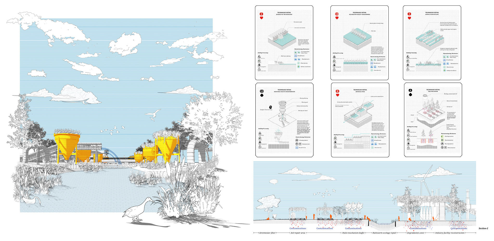
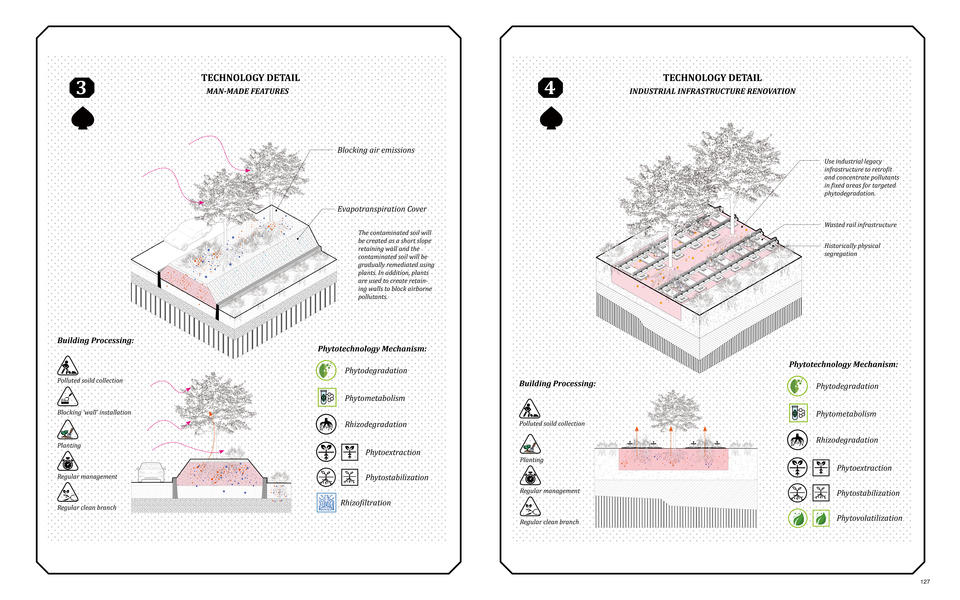
Filtering stormwater in the steel factory
Medium: Rhino, PS, AI, ID
Year: 2021
Image
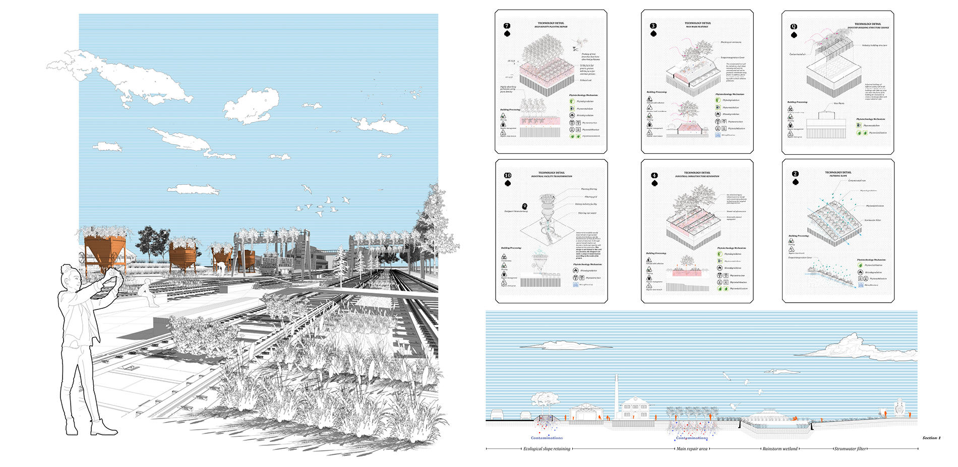
Railroad redevelopment in the steel factory
Medium: Rhino, PS, AI, ID
Year:2021
Image
Image
Image
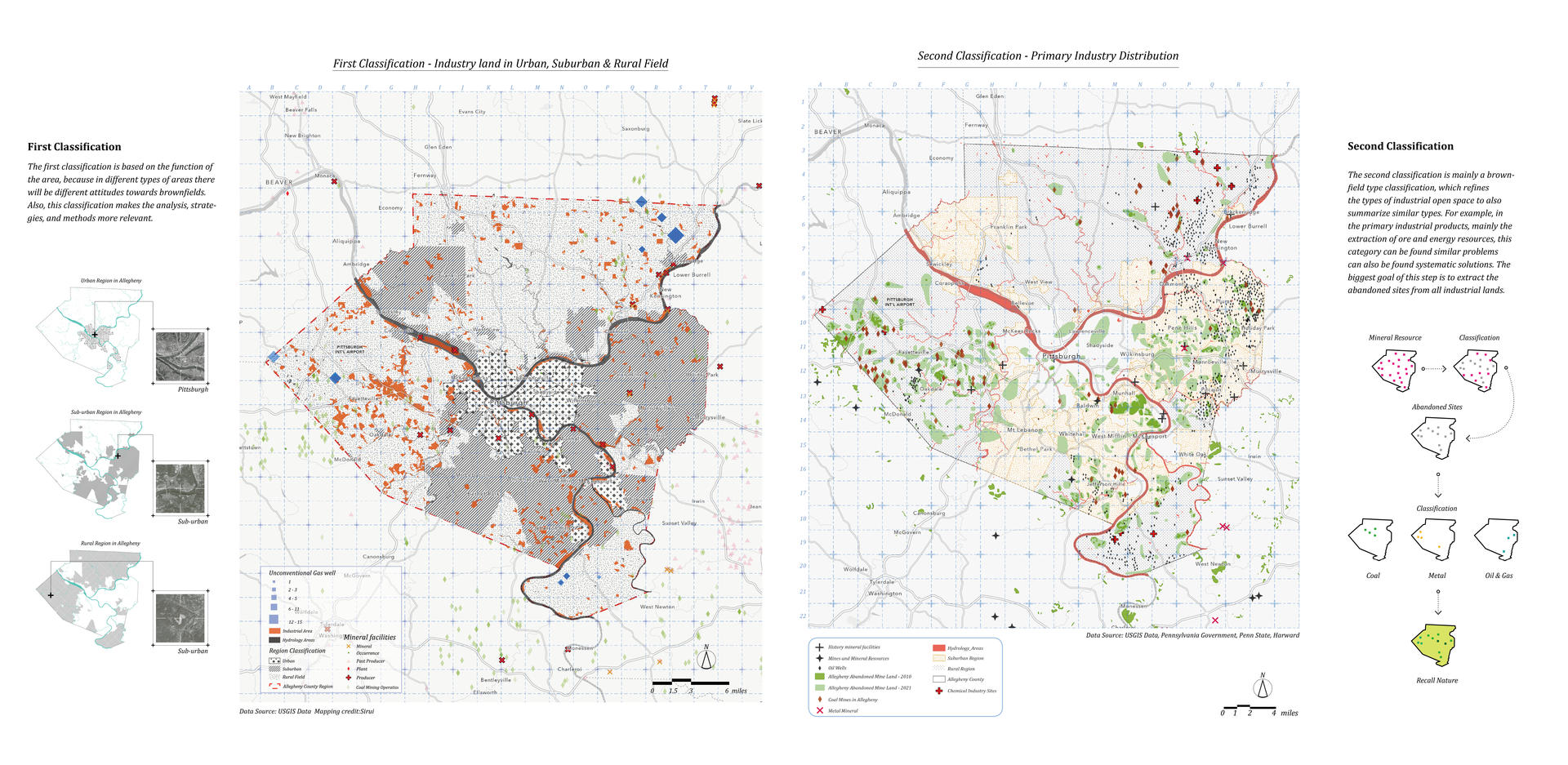
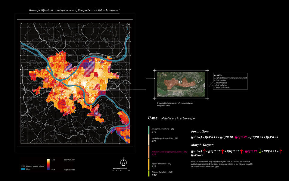
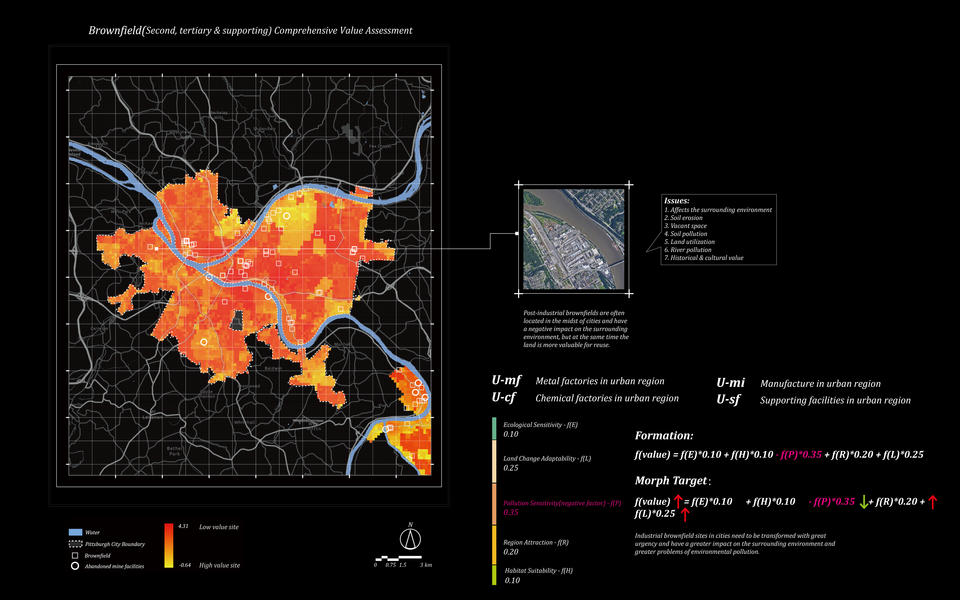
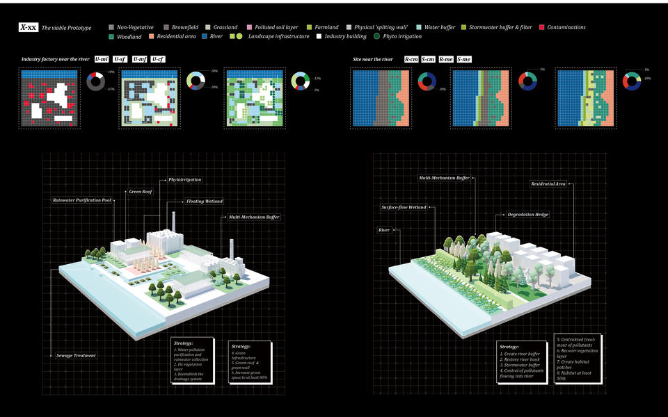
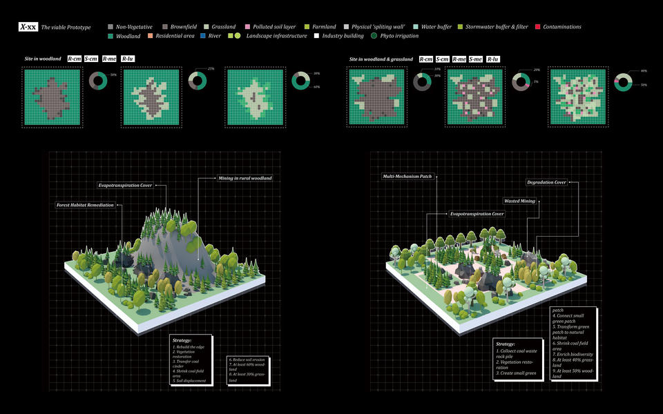
Brownfield Classification Mapping
Medium: ArcGIS Pro, Google Earth, AI, PS, ID
Data source: The Western Pennsylvania Regional Data Center, Pennsylvania Department of Environmental Protection
Year: 2021
Image
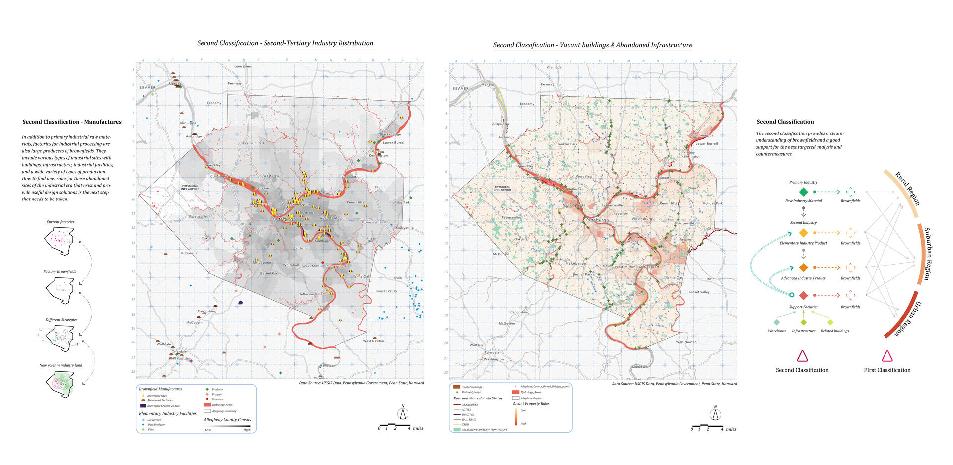
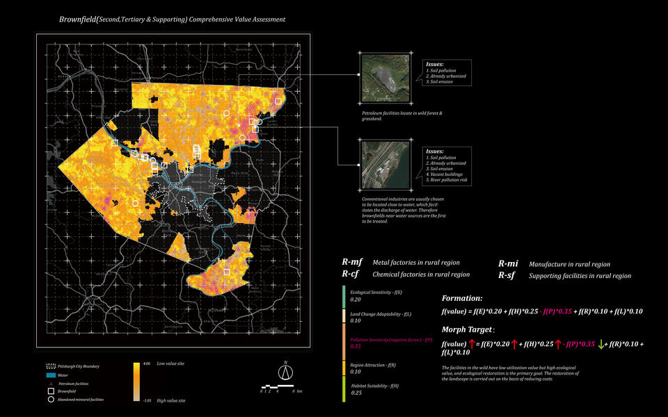
Brownfield Classification Mapping
Medium: ArcGIS Pro, Google Earth, AI, PS, ID
Data source: The Western Pennsylvania Regional Data Center, Pennsylvania Department of Environmental Protection
Year: 2021
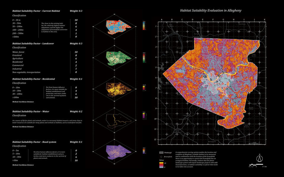
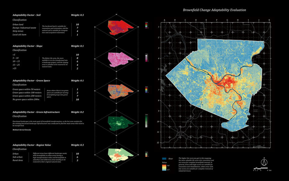
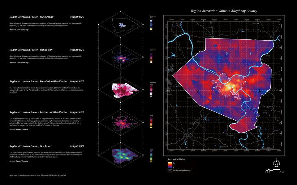
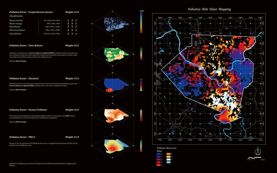
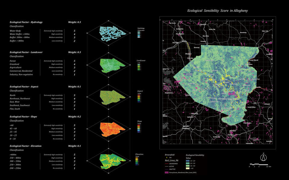
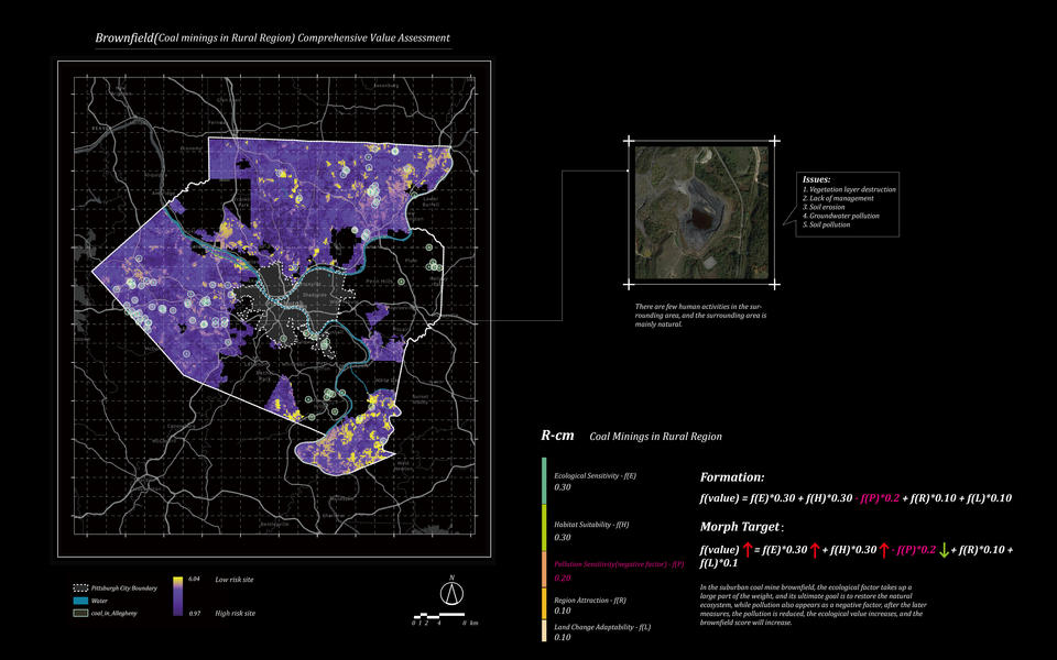
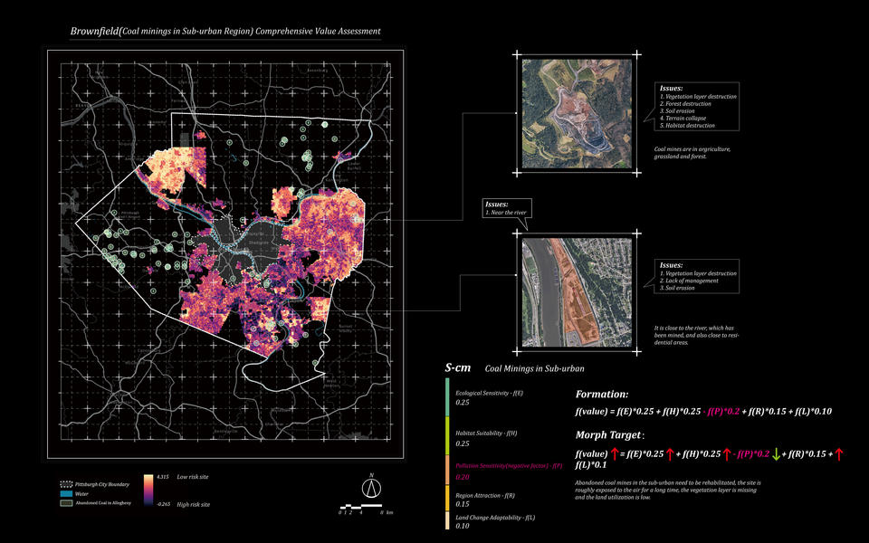
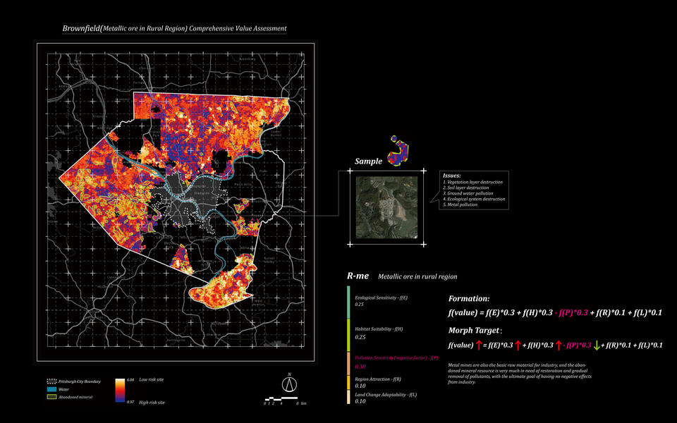
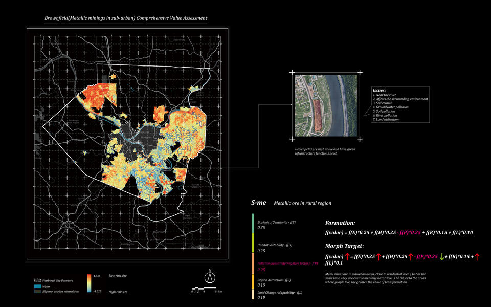
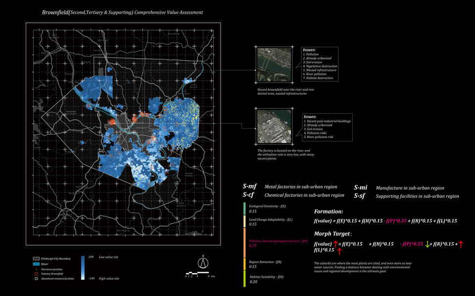
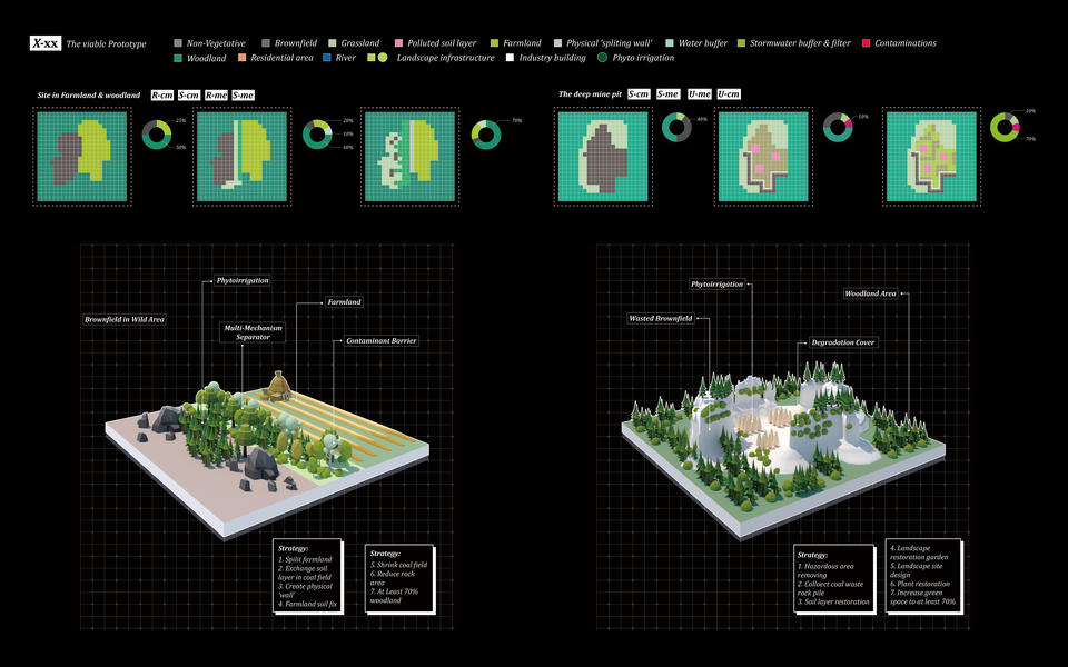
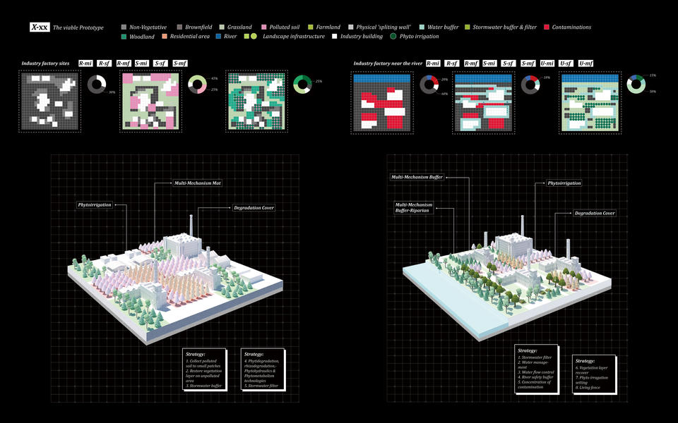
Related Factor calculating Mapping
Medium: ArcGIS Pro, AI, PS, ID
Data source: The Western Pennsylvania Regional Data Center, Pennsylvania Department of Environmental Protection
Year: 2021
ABSTRACT
This project is research on brownfields. Brownfield is a complex and integrated issue that is not only influenced by many factors but also affects society, urban development, ecology, etc. This project aims to study and analyze different types of brownfields in depth through big data, and to find a possible direction to solve the brownfield problem by using different calculation methods of relevant factors. At the same time, this research hopes to parallel the research and landscape design and provide suggestions for landscape architects while solving the brownfield problem.
This is a new attempt, a new methodology. Highlighting the research part frees up some of the pressure on landscape architects. After based on this new brownfield analysis system, according to the suggestions given by the system, the landscape architect can focus more on the creation of the landscape. In addition, the system differentiates the types of brownfield sites and finds more suitable strategies and directions for brownfield removal.