Jordan Voogt
Salt Infrastructures & Geographies
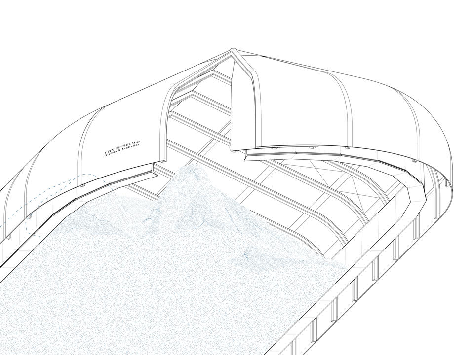
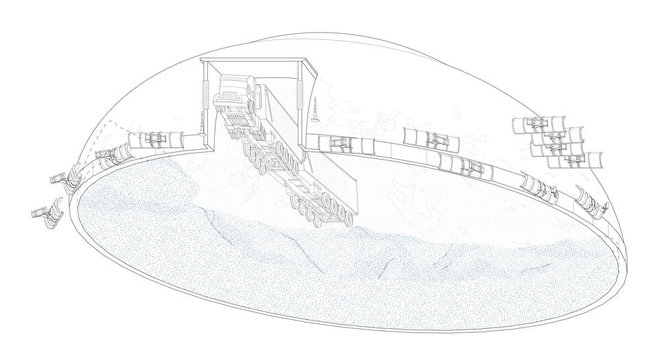
Salt is a granule, yet massive, component of public infrastructure. It has become a material staple of seasonal maintenance for municipalities across the Great Lakes region. The confluence of salt extraction and its territorial logistics has mapped itself across the urban landscape. The infrastructure in place to disperse road salt (the typological salt shed, the plow truck, the municipal district, and so on) becomes a delineator of urban territory onto itself. The Great Lakes region, with its geohistorical ties to salt, maintains a collection of salt mines and trade flows across the US and Canada. In this way, salt spans geological strata and transnational borders.
Salt Infrastructures & Geographies invites the public to take a walk through several Detroit neighborhoods, following salt as a multiscalar urban, geologic, and infrastructural agent; witnessing the effects of extraction on the city. This walk is a practice in social activism and observation. Residents embarking on the walk will be made aware of the mineral rights and land holdings of the Detroit Salt Co. mine operating beneath the immediate urban fabric and the role of road salt in polluting local freshwater.
Along the walking route, a new type of geological benchmark demarcates the scale of mining activity beneath walkers’ feet. This intervention visualizes the invisible boundaries of subsurface mineral rights beneath city streets and their alignment with Detroit’s urban planning. After passing through zones of urban maintenance and industrial affairs, the walk concludes at Belanger Park: the last remnant of publicly accessible waterfront within the area.
On this site, the typological language of the municipal salt shed is reappropriated to create a new shed for the gathering of municipal laborers, local residents, and Detroit’s many environmental activists. On the banks of the Detroit River the shed allows space for residents to monitor the quality and salinity of their water and consider the industrial powers within their community. Across the river, on the other side of the US-Canadian border lies the Windsor Salt mine, serving as a reminder that geology supersedes borders and economic arrangements.
Image
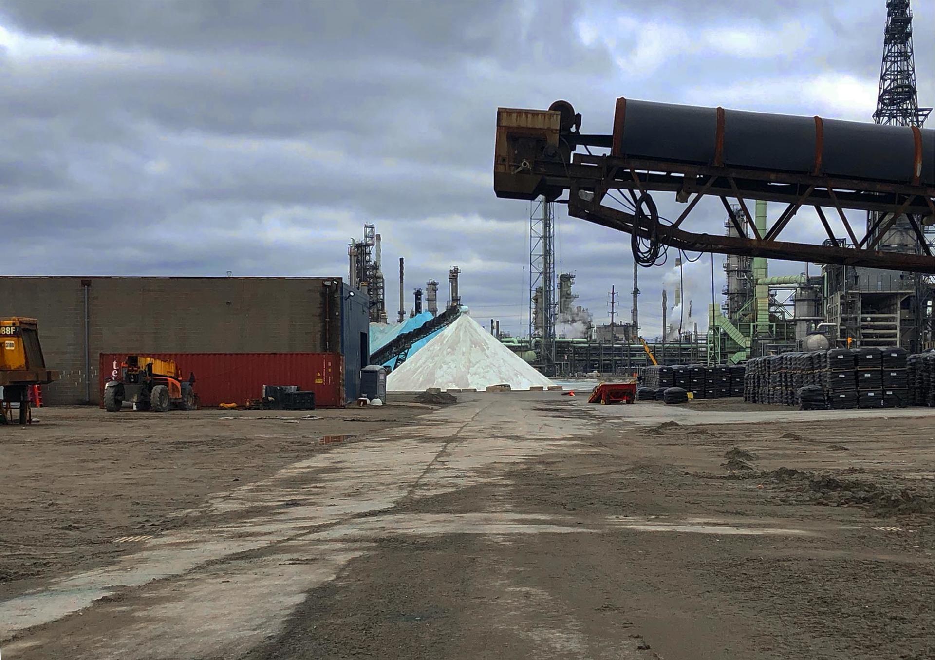
Scenes from the Detroit Salt Mine
A Walk Through the Salinated Landscape
Salt Infrastructures & Geographies invites the public to take a walk through several Detroit neighborhoods, following salt as a multiscalar urban, geologic, and infrastructural agent; witnessing the effects of extraction on the city. This walk is a practice in social activism and observation. Residents embarking on the walk will be made aware of the mineral rights and land holdings of the Detroit Salt Co. mine operating beneath the immediate urban fabric and the role of road salt in polluting local freshwater.
Image
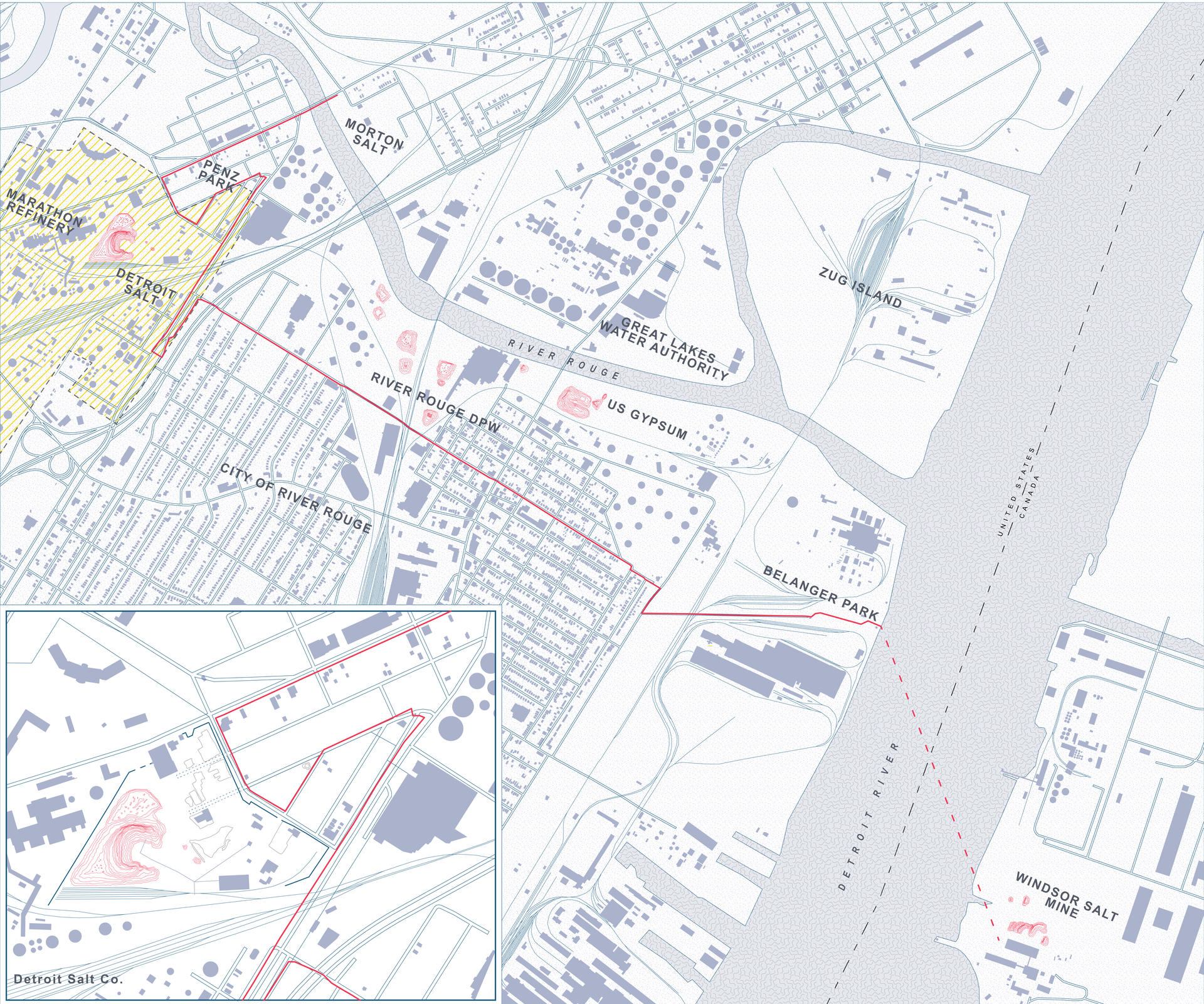
The route of the walk: passing over the mineral rights of the Detroit Salt Co. and past several sites of salt stockpiling and urban maintenance
Scales of Extraction
Along the walking route, a new type of geological benchmark demarcates the scale of mining activity beneath walkers’ feet. This intervention visualizes the invisible boundaries of subsurface mineral rights beneath city streets and their alignment with Detroit’s urban planning.
Image
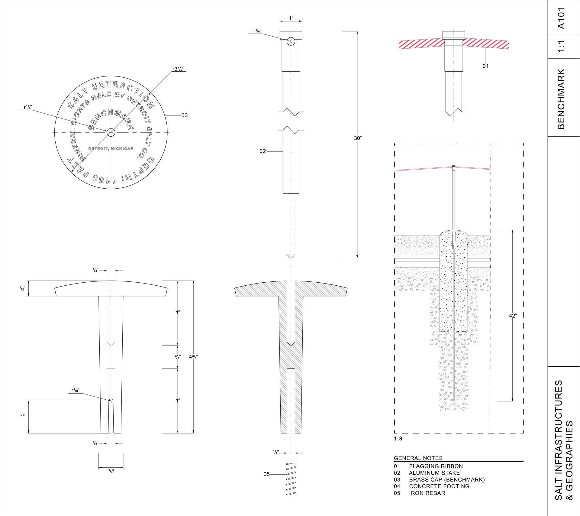
A new benchmark in the city: demarcating mineral rights and scales of salt extraction beneath the urban fabric of Detroit
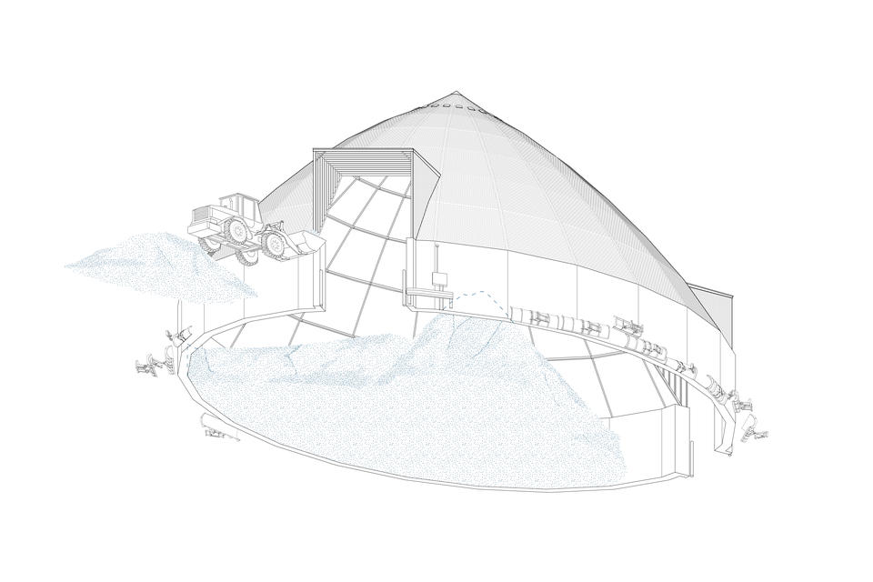
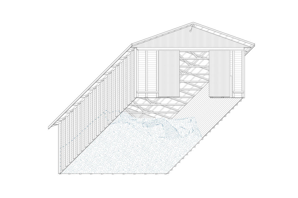
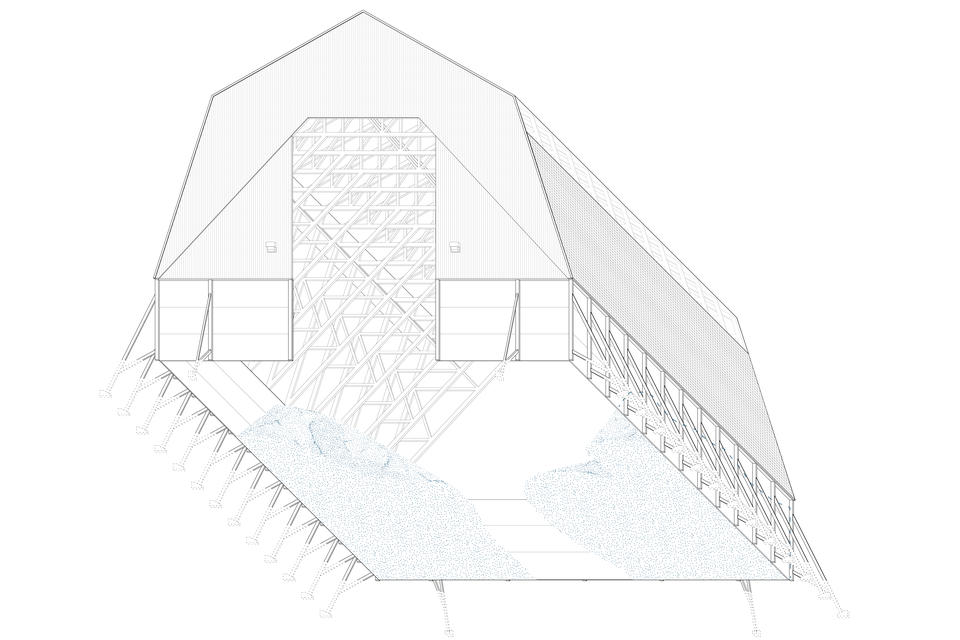
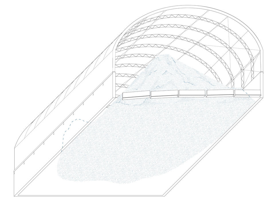
The Municipal Shed as Typology and Opportunity
After passing through zones of urban maintenance and industrial affairs, the walk concludes at Belanger Park: the last remnant of publicly accessible waterfront within the area. On this site, the typological language of the municipal salt shed is reappropriated to create a new shed for the gathering of municipal laborers, local residents, and Detroit’s many environmental activists. On the banks of the Detroit River the shed allows space for residents to monitor the quality and salinity of their water and consider the industrial powers within their community. Across the river, on the other side of the US-Canadian border lies the Windsor Salt mine, serving as a reminder that geology supersedes borders and economic arrangements.
- Architecture
- Ceramics
- Design Engineering
- Digital + Media
- Furniture Design
- Global Arts and Cultures
- Glass
- Graphic Design
- Industrial Design
- Interior Architecture
- Jewelry + Metalsmithing
- Landscape Architecture
- Nature-Culture-Sustainability Studies
- Painting
- Photography
- Printmaking
- Sculpture
- TLAD
- Textiles