Carl Garvey
Beach Autonomous Zone
This project responds to issues surrounding beach erosion on Long Island’s Atlantic Coast by envisioning policy and design decisions that activate a destabilization of the shoreline and a managed retreat away from beaches to encourage a more dynamic and resilient coastal system. Contrasted to methods and goals of conventional coastal engineering, a beach autonomous zone sets an extended setback in which coastlines are treated, in effect, as conservation easements, allowing beaches return to more undeveloped states. On several sites, I visualize negotiations between human desires and the needs of a beach that arise under this spatial designation.
This project’s outcome is the beginning of a coastal planning approach that balances beach autonomy with access and cultural preservation. Despite staggering logistical challenges, this project serves as a representation of alternative strategies for sustainable cohabitation with coasts and a starting point for difficult conversations about choices we face on eroding shores.
Initial research for this project revealed that Long Island's Atlantic Coast has a long history of major storms and shoreline stabilization and protection projects. The frequency of these projects appears to have increased alongside of a massive growth in population.
Image
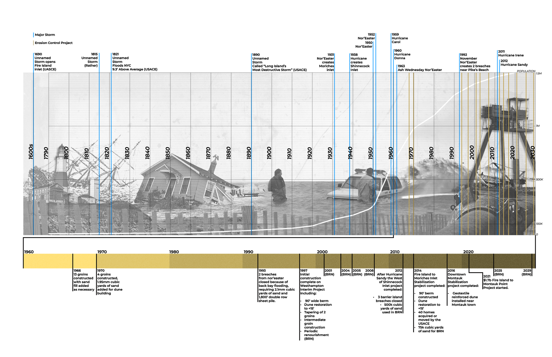
Timeline of East End Storms & Erosion Control Projects
Digital Drawing & Collage, 24" x 36"
Today the coast from Fire Island to Montauk is comprised of a patchwork of parkland and different at-risk suburban fabrics.
Image
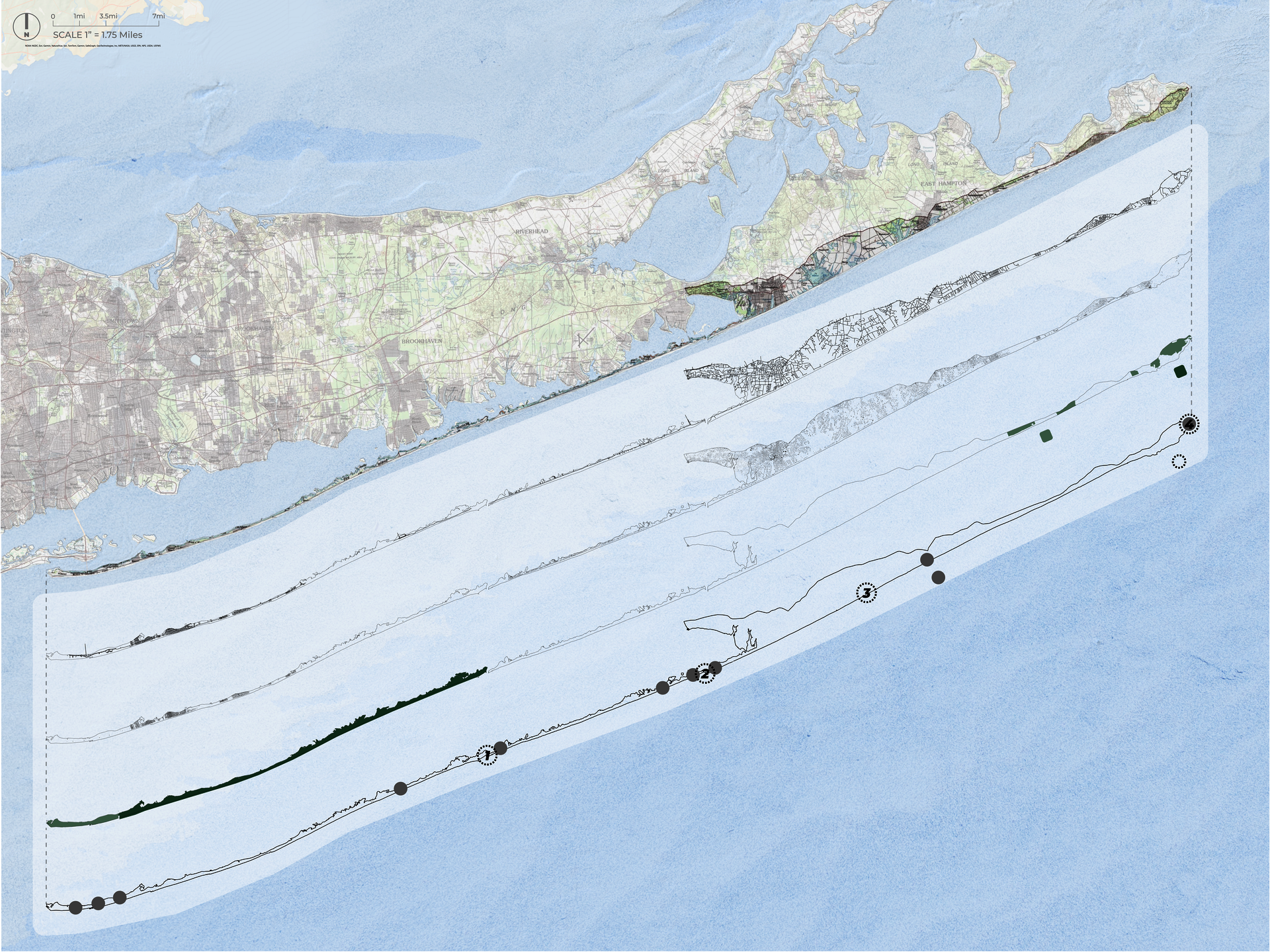
Current Coastal Urbanization From Fire Island To Montauk.
Digital Map, 24" x 26"
Montauk Point
Image
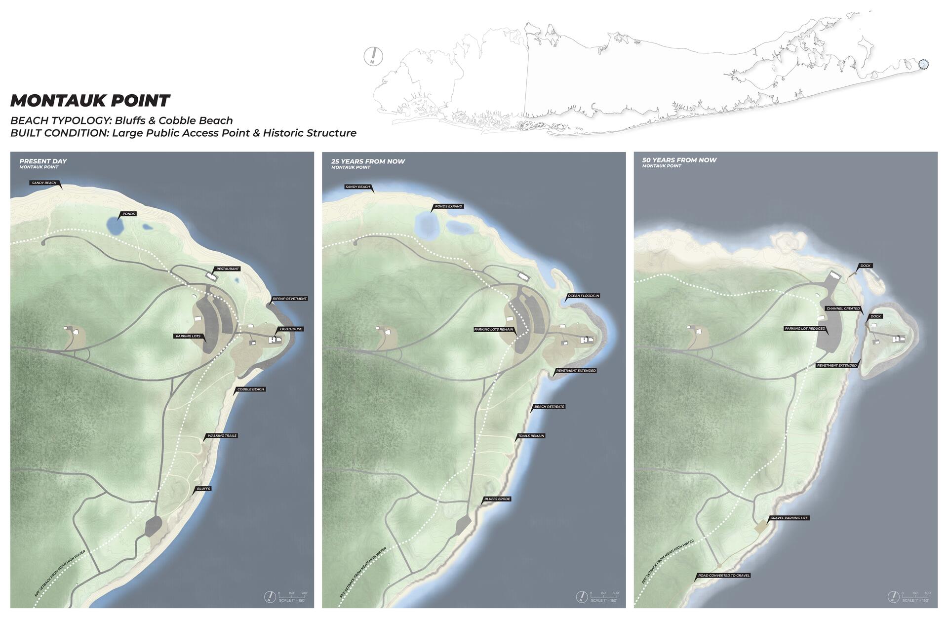
Possible Evolution of Montauk Point From Present to 50 Years In the Future
Digital Drawing, 46" x 30"
In the premise of this project, an exception is made to prevent the land surrounding Montauk Lighthouse from eroding completely, losing the historic structure. As sea levels rise and the rest of the bluffs erode, that would leave behind the newly formed Montauk Island.
Image
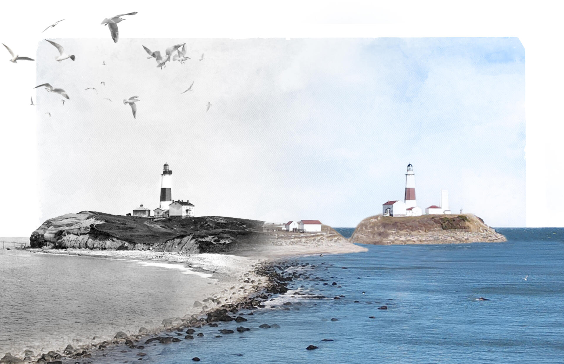
Montauk Point Circa 1990 to Montauk Island Circa 2075
Digital Collage, 11" x 17"
Smith Point
Image
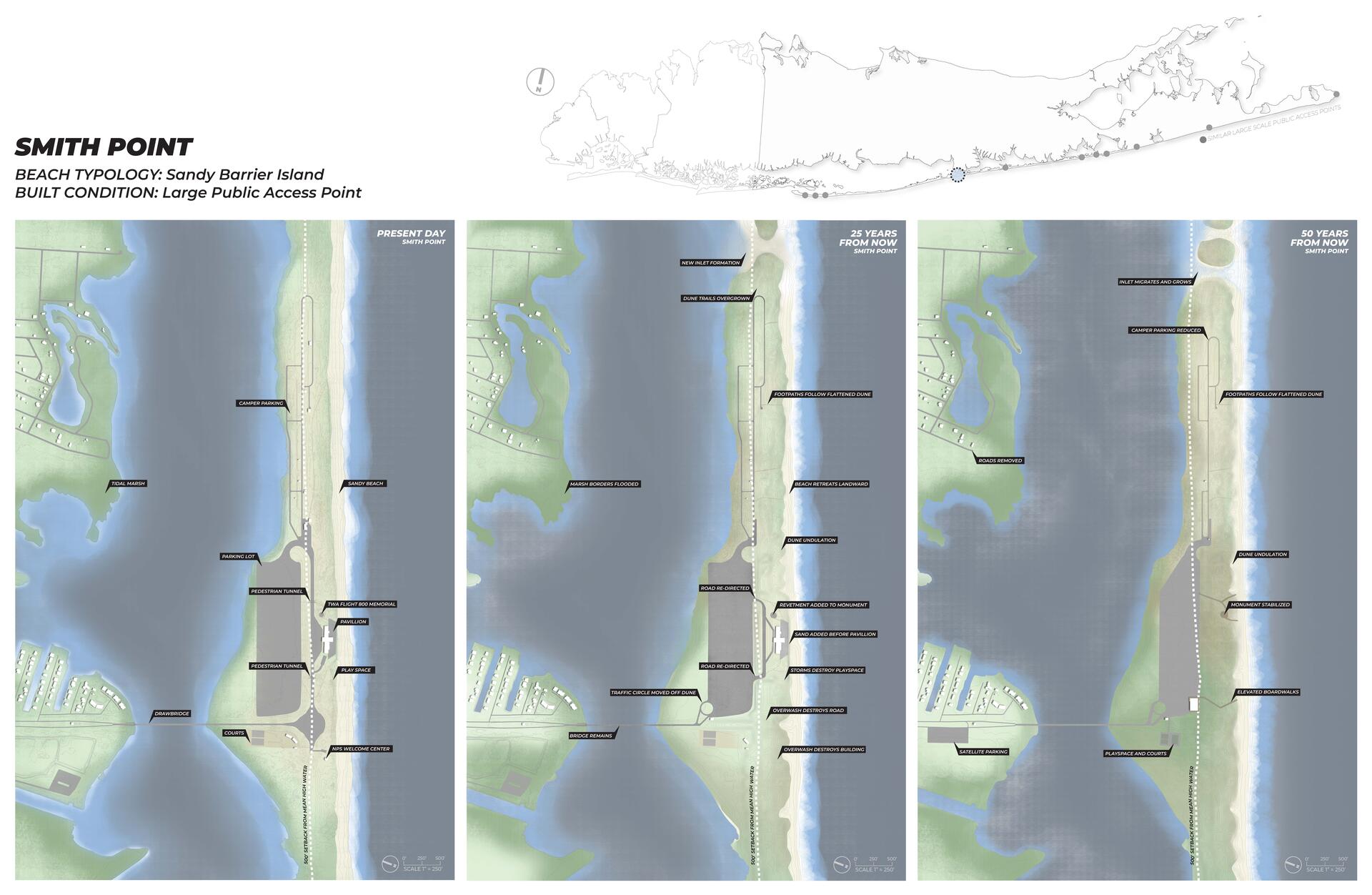
Possible Evolution of Smith Point From Present to 50 Years In the Future
Digital Drawing, 46" x 30"
As storms and erosion damage structures, programming opportunities at the beach can shift into mobile modalities. This ensures the beloved beach experience remains but in a more sustainable way, without unnecessary infrastructure that goes unused for much of the year.
Image
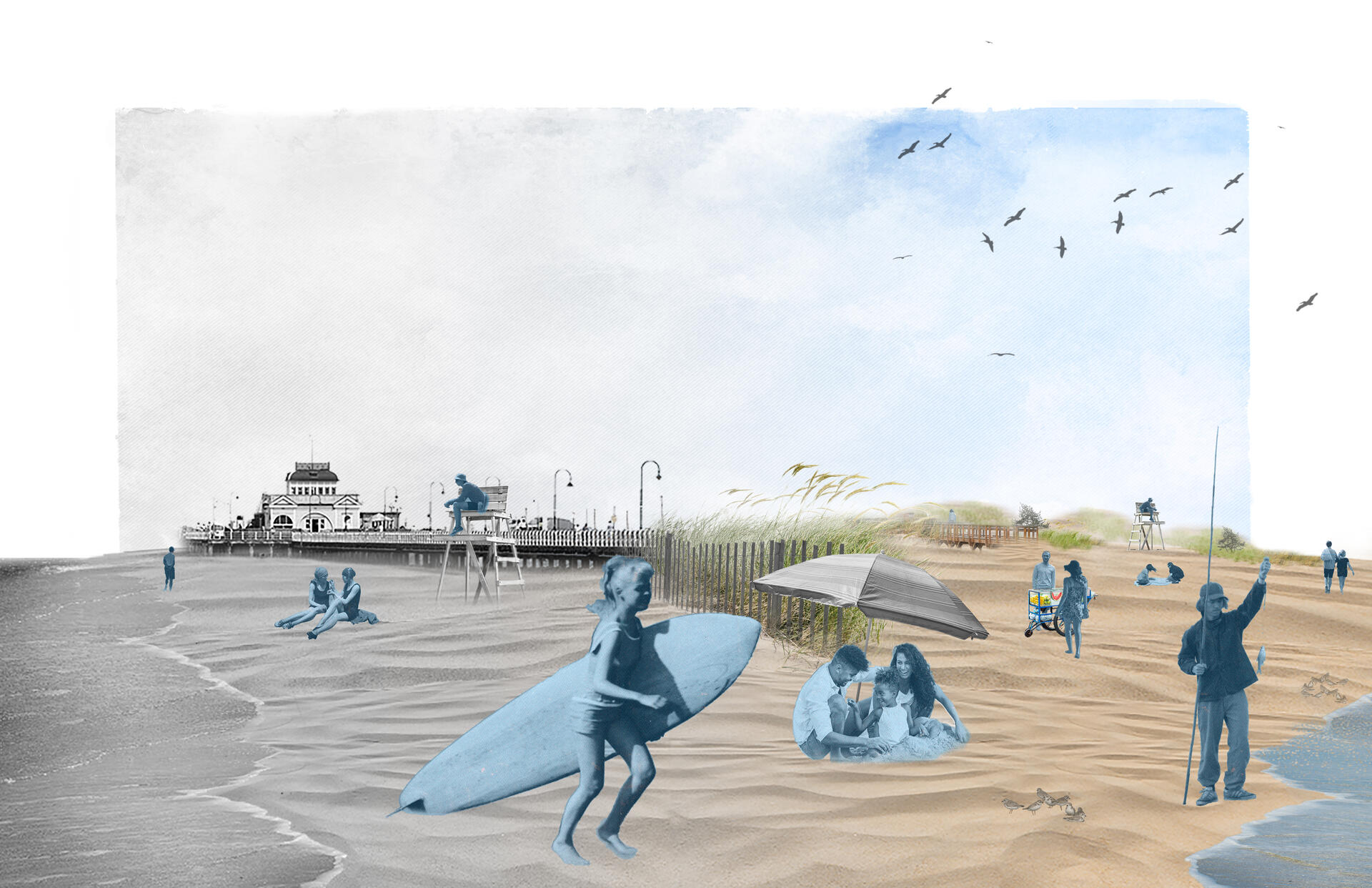
Shifting Away From Infrastructure & Onto Sand
Digital Collage, 11" x 17"
Fire Island
Image
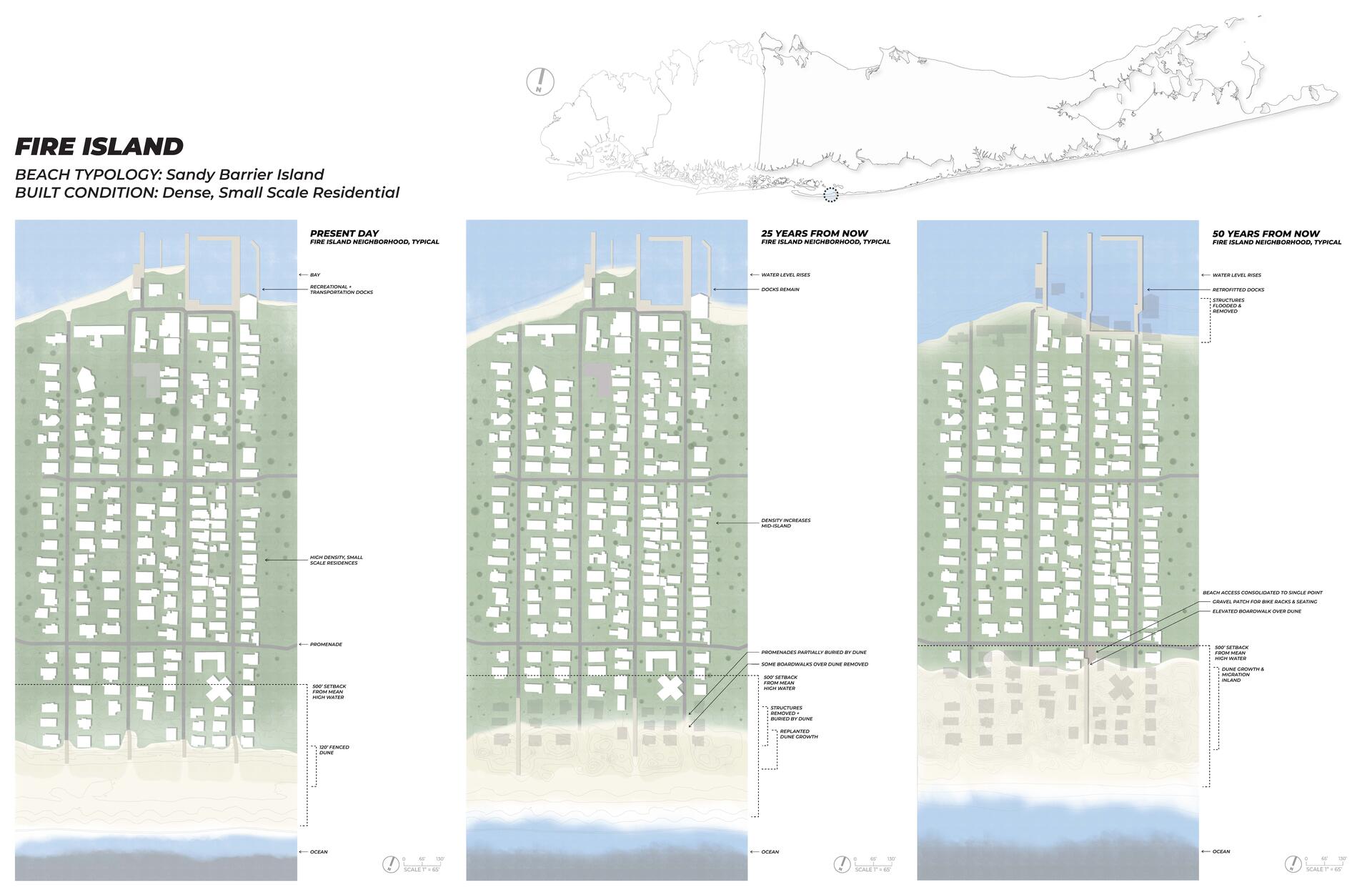
Possible Evolution of A Fire Island Neighborhood From Present to 50 Years In the Future
Digital Drawing, 46" x 30"
Whether under the premise of this project or actual ongoing shoreline protection projects on Long Island's Atlantic Coast, the experience of arriving to the dune to get to the water's edge will change. in a beach autonomous zone however, unlike conventional coastal engineering, structural remnants can be seen as a sign of progress towards a healthier, more resilient beach that could be beneficial to entire communities.
Image
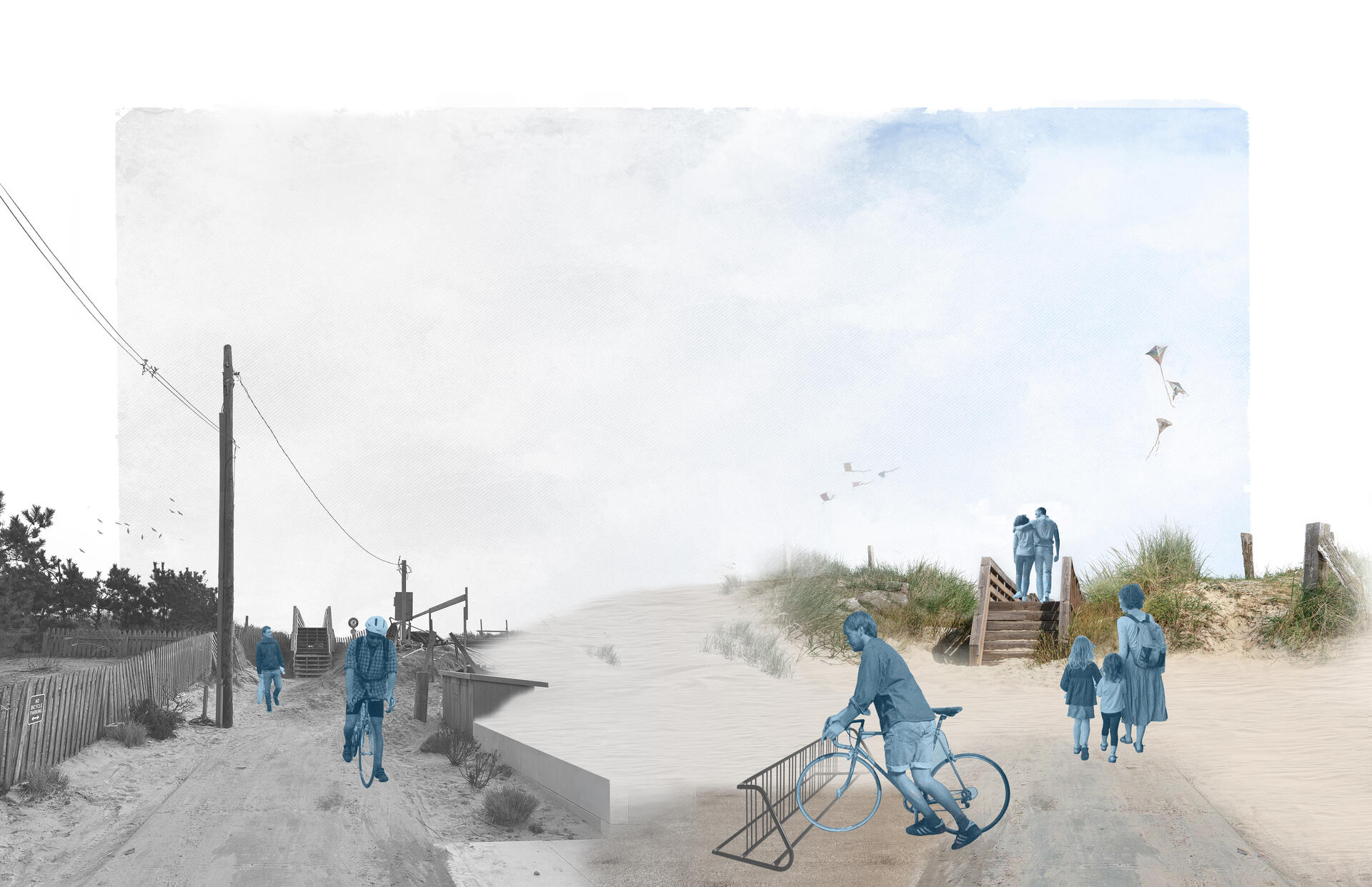
The Changing Beach Experience
Digital Collage, 11" x 17"