ABSTRACT
Residents of the Olneyville neighborhood in Providence, RI are at the cusp of being gentrified and forced to relocate. Revitalization of the Woonasquatucket River Greenway and the redevelopment of adjacent neighborhoods such as the West End and Federal Hill are attracting investors' attention on undeveloped post-industrial properties in Olneyville. This study aims to determine how gentrification can be reduced to minimize the impacts on the inhabitants of Olneyville Specifically, it investigates the social and physical conditions and designs potential solutions that can regenerate the urban brownfields in a way that fortifies the neighborhood from gentrification. In this context, "Regenerate" is defined as to repurpose a piece of undeveloped post-industrial mill property critical to the health and welfare of the community.
In developing the comprehensive regeneration strategies appropriate to this specific neighborhood and environment, the thesis studies the relationship between brownfields and gentrification. The work analyzes the neighborhood from different perspectives and research methods conducted on both urban and site scales. The strategies are divided into three parts: landscape frameworks, cultural programming, and economic indicators. The major focus of the design investigation lies on the landscape frameworks as primary vehicles for the regeneration of the post-industrial brownfield sites.
Brownfields
& Environmental Justice
Image
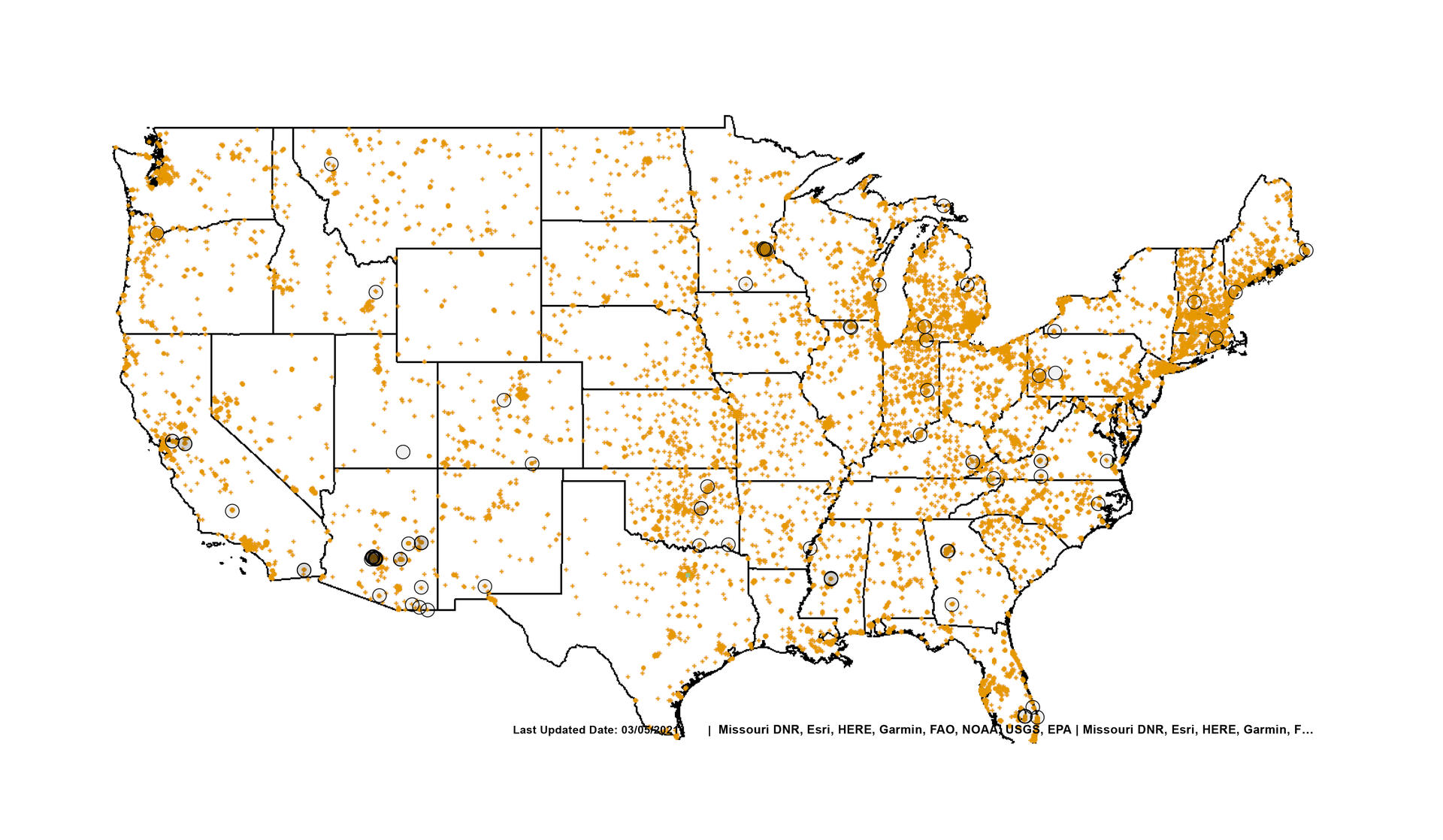
▲ Map of Granted Brownfields in the US
More than 450,000 brownfields are recognized by the United States Environmental Protection Agency (EPA).1 The map above shows the latest update on granted brownfield sites from Cleanups in My Community (CIMC)
Image
▲ Map of Granted Brownfields in the US
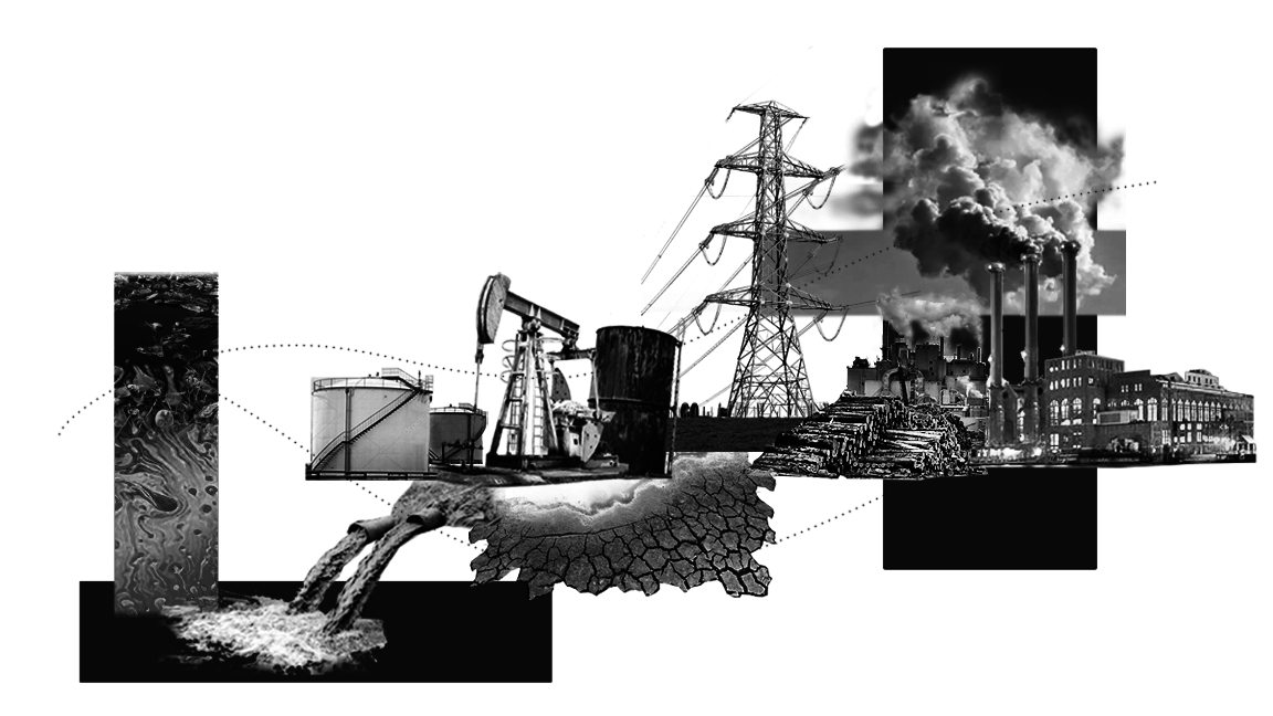
One of the most common brownfield types is post-industrial sites; they can be as small as corner gas stations in cities, dry-cleaning operations and stores, or as big as textile mills, manufactured gas plants, metal-plating factories, chemical manufacturing, oil-tank farms and etc.2
Image
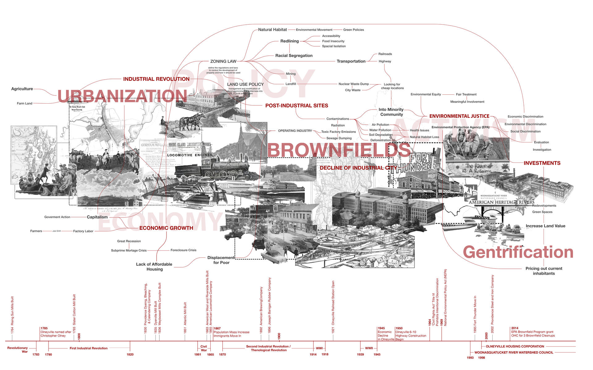
▲ History of Brownfields and Environmental Justice
To learn about the causes and effects of brownfields, intersecting the overall history of brownfields and the history of Olneyville which is the site of the thesis, to see how the history of development has reflected in that particular neighborhood. Two major forces as the Economy and Policy that drive the development of urbanization and creating unjust actions towards the placement of toxic factories and minority neighborhoods. Activisms led by the Environmental Justice movement addressed injustice issues throughout the US. Many revitalization projects were greatly improving these injustice neighborhood environments but also begin the gentrification process.
Olneyville
Image
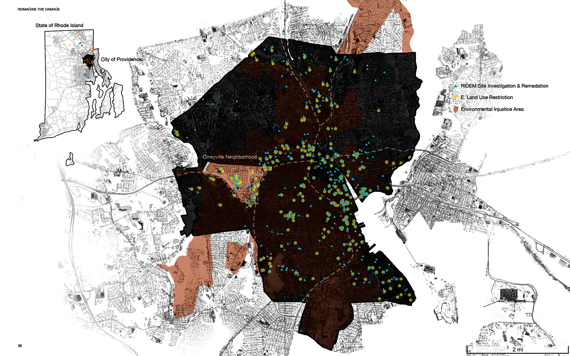
▲ Providence, RI is known as a post-industrial region. During the 19th century, it was a time of intense manufacturing. Providence was once home to the largest tool factory in the United States, Providence Tool Company, and ranked first nationally in the manufacture of jewelry and wool production.3 According to EPA’s brownfields program “Cleanups In My Community (CIMC)”, Providence today has 229 sites included in the public database that are marked or designated either as brownfields or superfunds.4 This number is only a “guesstimate,” for the ones with assessments, the actual number of brownfields is still unknown.
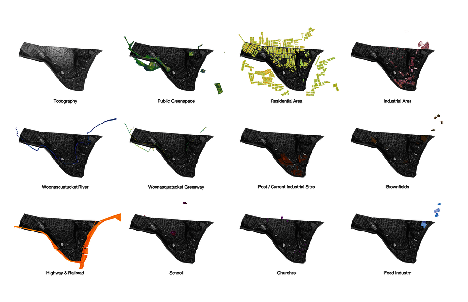
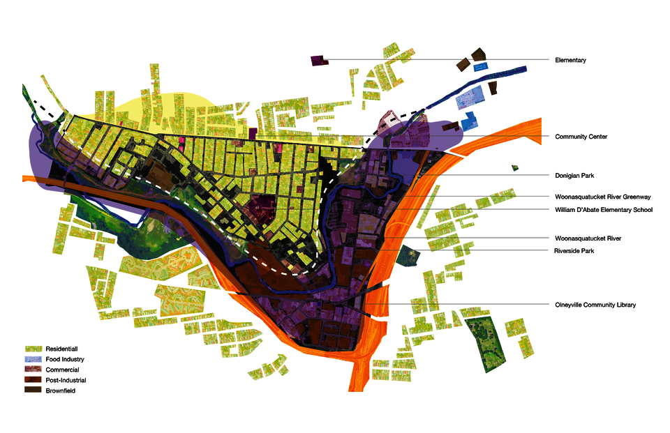
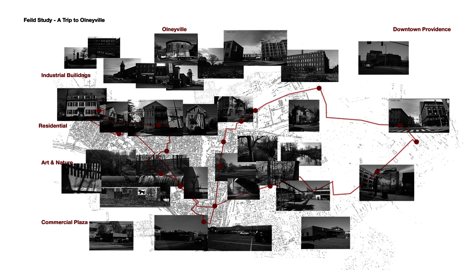
▲ To have a comprehensive view of Olneyville, data was gathered through mapping & analysis, field study with site visits, and semi-structured interviews. The goal was to get not only an overview of this neighborhood, but also an understanding of some of the causes and effects of this community's current situation through different lenses.
Strategies
Image
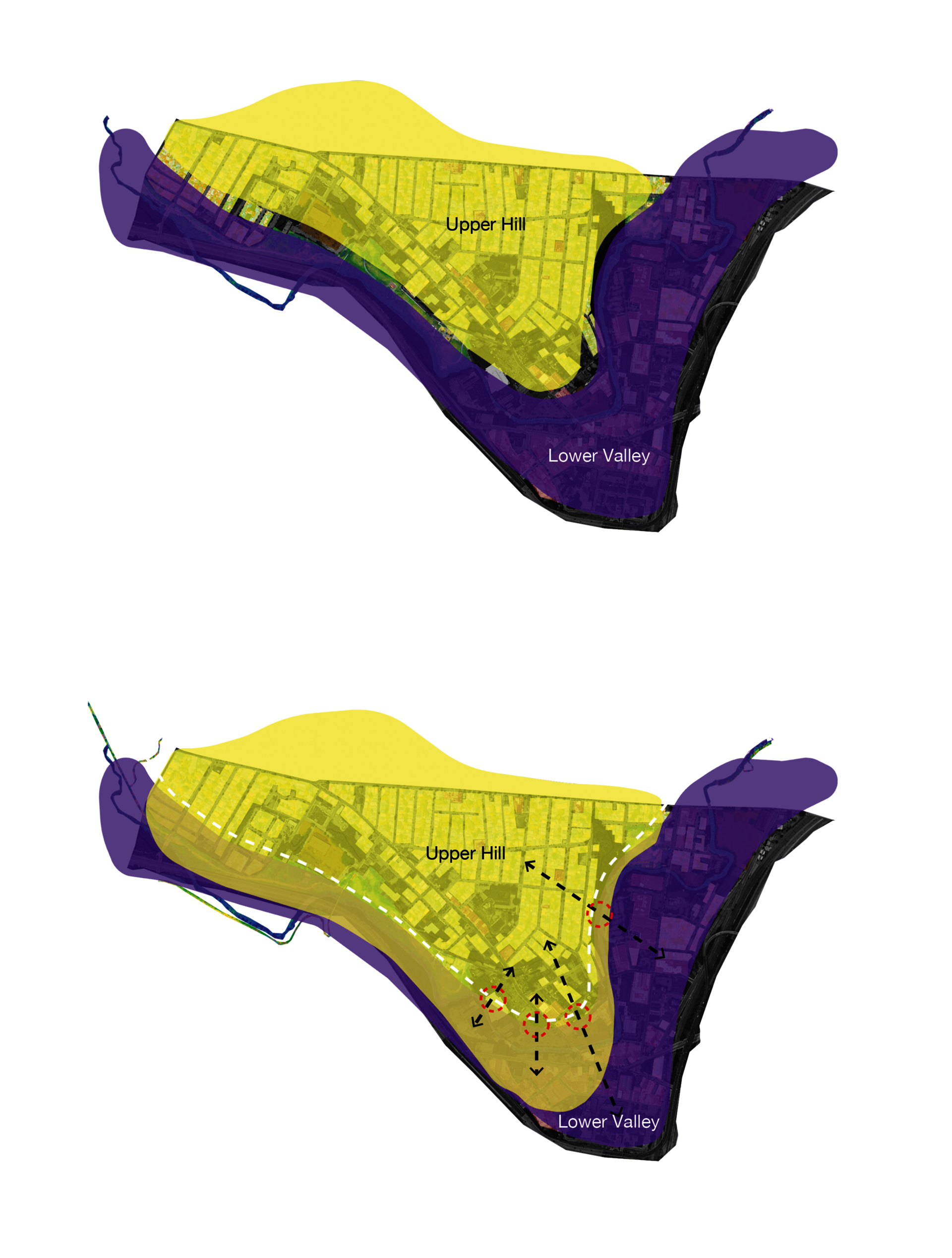
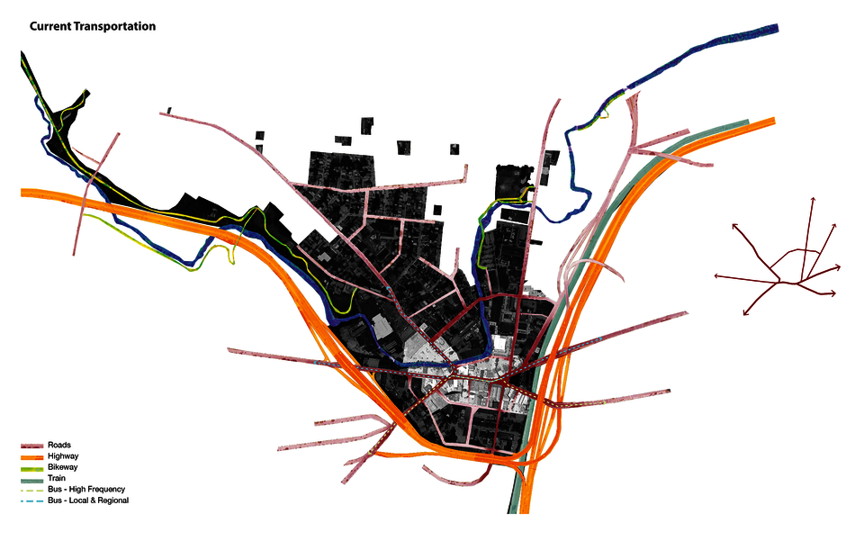
▲ With an explicit aim of connecting the two parts of Olneyville – the valley with commercial activities and the hill where the community resides – a series of strategies were explored. These strategies try to link the two landforms and, at the same time, bring more activities into the center of Olneyville.
Image
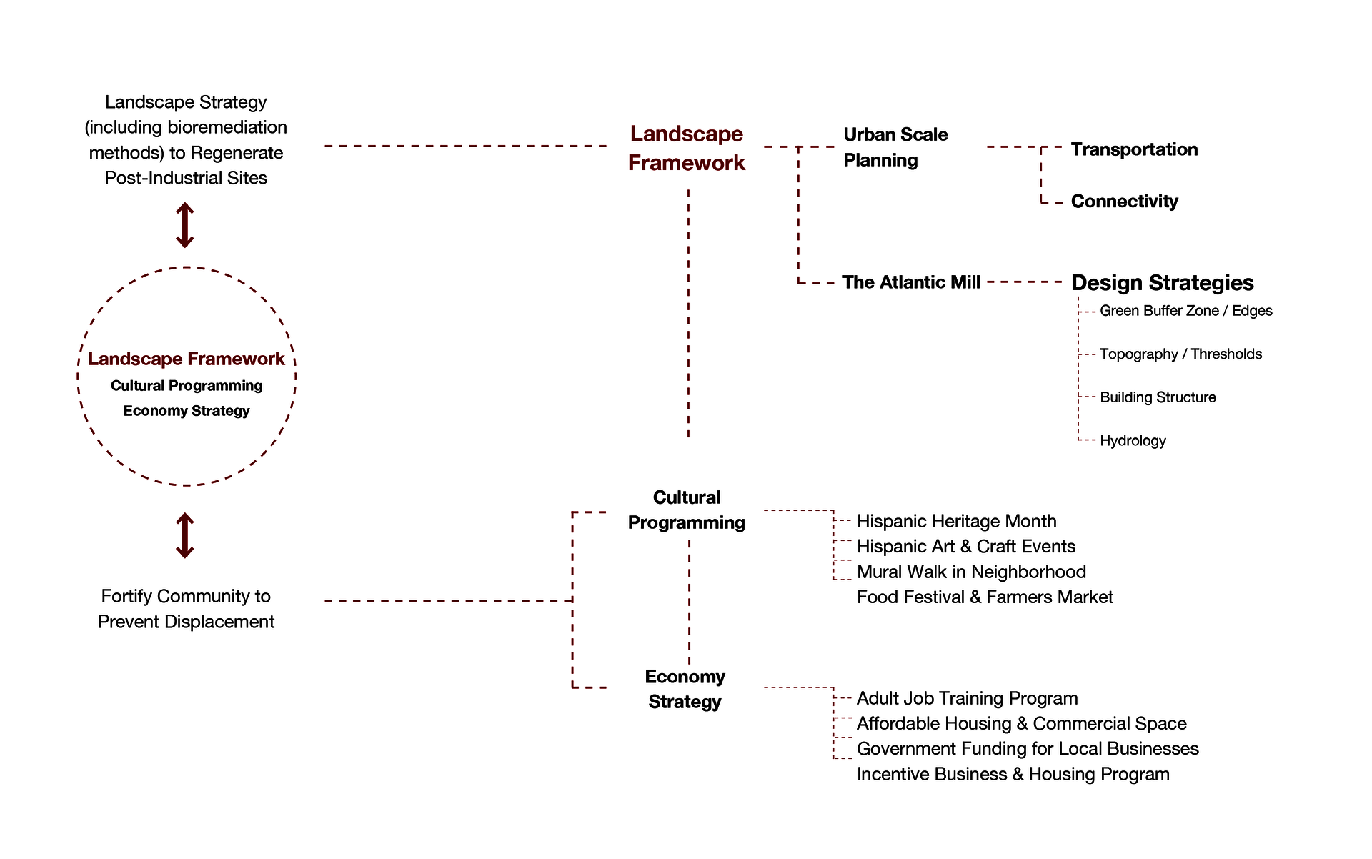
▲ The aforementioned strategies have two main objectives: first, to explore landscape frameworks for cleaning up post-industrial sites. Second, to look for ways to fortify the community, helping them deepen their roots in Olneyville. To achieve these two objectives, landscape is used as a primary vehicle, fully integrated with the support from cultural programming and economic strategies.
Image
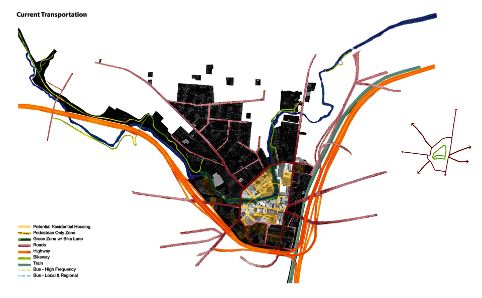
▲ To resolve and eliminate the traffic conjunction, I propose a new urban transportation system around Olneyville Square. The proposal involves closing the center of Olneyville and creating a pedestrian-only walking zone as the inner loop while shifting the roads outward and creating an outer loop. The pedestrian zone will create opportunities for the surrounding districts to commute in and out of Olneyville. The bike lanes can be connected along the river and be new green corridors in the urban environment. By increasing the number of residents around Olneyville Square, there will be more human activities in the area.
Image
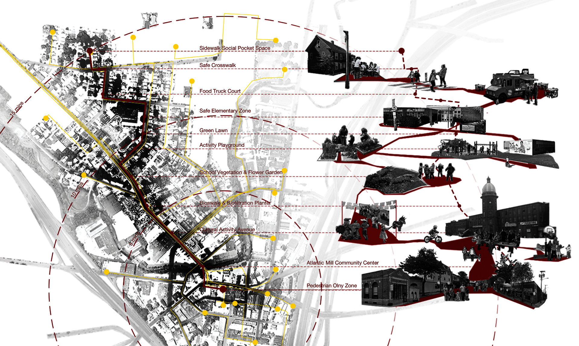
▲ Culturally related implementations will be applied into the community, corporate with neighborhood organizations to create a better living environment.
Atlantic Mills
Image
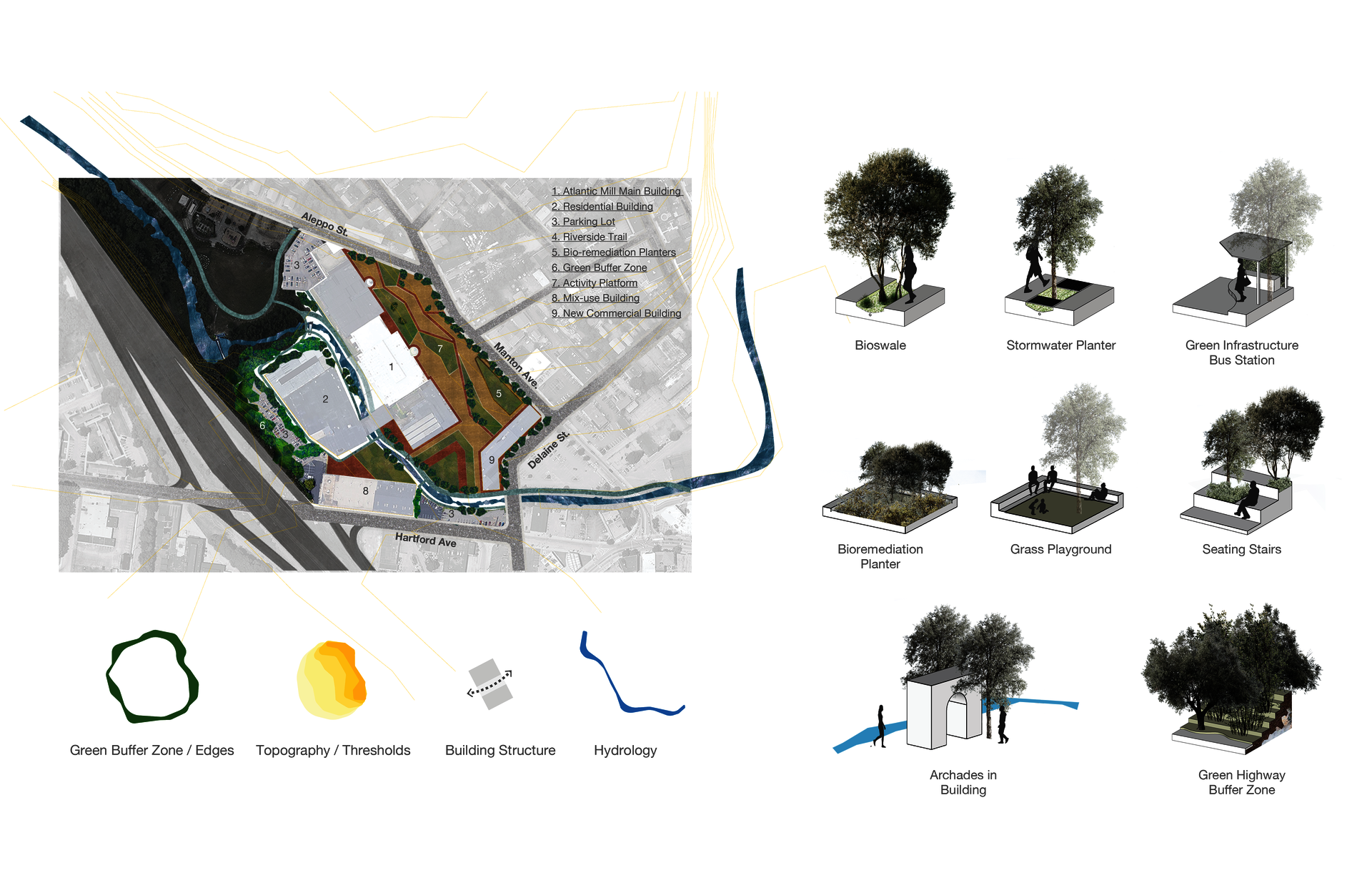
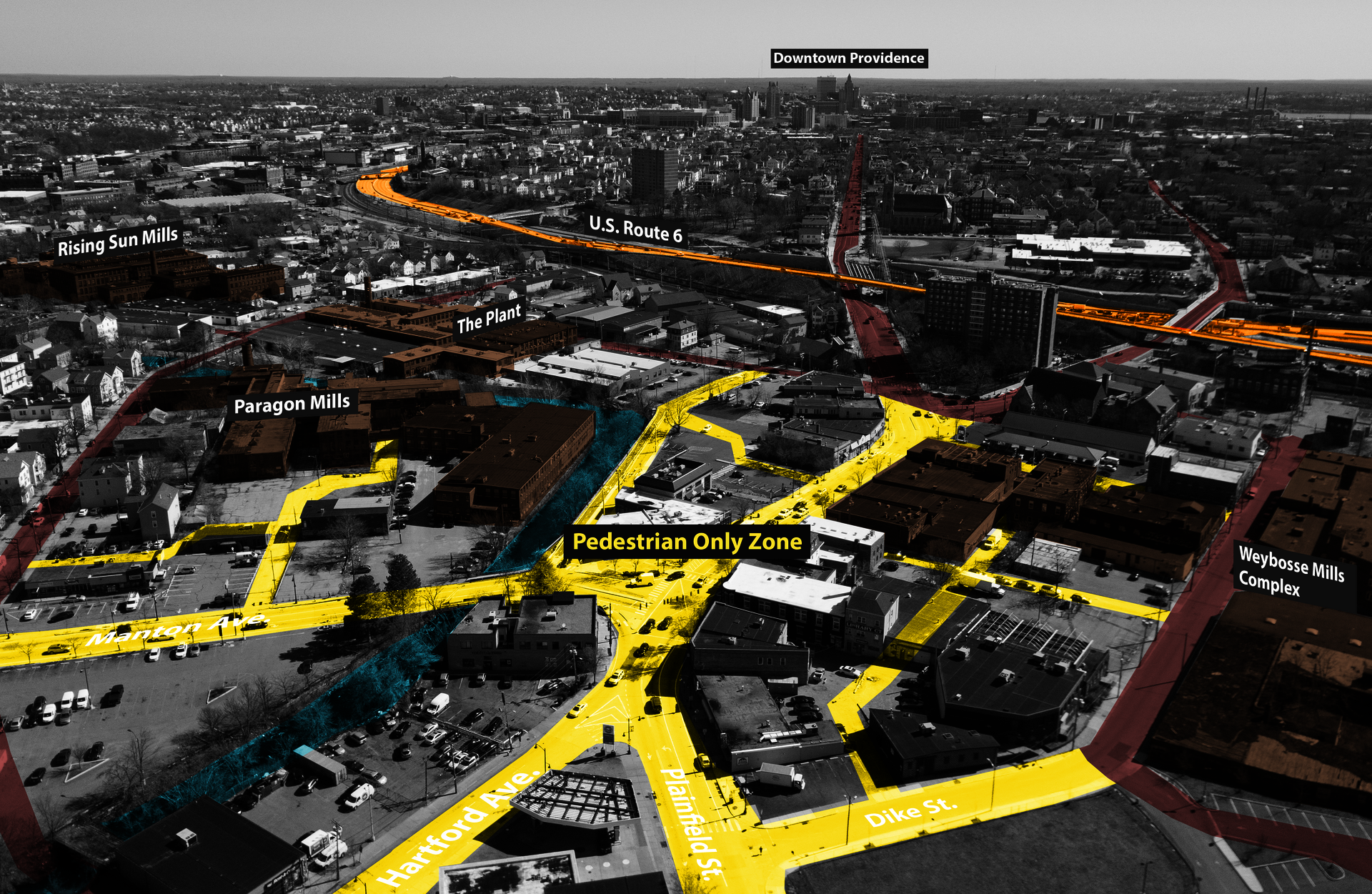
▲ With the proposed urban routes, consideration was made on two major issues around Olneyville square: first, Manton Avenue will be the major route leading traffic and pedestrians into the Olneyville square; second, the gentrification forces coming from the arts districts and adjacent neighborhoods. The community needs a place that can become their holding ground to minimize the trend of gentrification forces encroaching on to the rest of the neighborhood. The Atlantic mill on Manton Avenue will be a critical place to pass through for anyone who wants to go to the Olneyville square. This place can work as a hinge between the two sides of the neighborhood. With a huge potential for the community to take over and working together with the landscape framework, economic strategies, and cultural programming, this place can work as a self-running community incubator that potentially does not need outside support.
ANNOTATED BIBLIOGRAPHY
- “Overview of EPA’s Brownfields Program.” EPA. Environmental Protection Agency, February 5, 2021. https://www.epa.gov/brownfields/overview-epas-brownfields-program.
- Hollander, Justin B., Niall Kirkwood, and Julia L. Gold. Principles of Brownfield Regeneration: Cleanup, Design, and Reuse of Derelict Land. (Washington: Island Press, 2010), 2.
- “Providence: ‘Three and ONE-HALF Centuries at a Glance.’” Accessed March 21, 2021. https://web.archive.org/web/20060113213109/http://www.providenceri.com/….
- EPA, “Cleanups and Grants Listing Page” (number of cases in Providence region, EPA). https://ofmpub.epa.gov/apex/cimc/f?p=101:10::::::
ENDNOTES
- Jerzyk, Matthew. “Gentrification’s Third Way: An Analysis of Housing Policy & Gentrification in Providence.” Harvard Law & Policy Review 3, Number 2 (2009): 413–29.
- Kennen, Kate, and Niall Kirkwood. Phyto: Principles and Resources for Site Remediation and Landscape Design. New York: Routledge, 2017.
- Liberman, Ellen. “How Has Gentrification Changed Providence?” Rhode Island Monthly, March 14, 2019. https://www.rimonthly.com/how-has-gentrification-changed-providence/.