Jingyu Ge
Cities of Tomorrow - Future Urban Planning Strategies
The tipping point is when a series of small changes or incidents becomes significant enough to cause a larger, more important change. Therefore, a city’s tipping point means the weakness that may affect the city’s future developing direction and potential. Urban planning aims to increase the city's resiliency, so the city will be less likely to reach the tipping point during the hyper-development.
This thesis will start with an urban planning theory generation and bring a new understanding of a good plan’s role using the case study of Singapore, a city with a low “tipping point” due to the local climate and limited resources. The research will focus on where are Singapore’s vulnerable points and what Singapore did to maintain sustainable development.
After the research, we discovered that Singapore still has unsolved crises that may lower the tipping point. A site in Singapore has been chosen to test the urban planning theory. The proposed design for this site integrates existing development strategies while solving the tipping point issue mentioned above at the same time.
Image
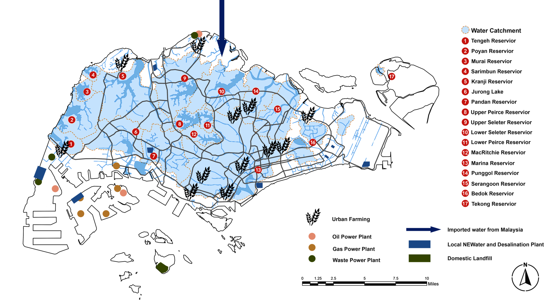
Water: Four National Taps include water from the local catchment, imported water, NEWater, and desalinated water.
Food: 90% of Singapore’s food is imported from 170 countries.
Power: About 78% of the overall capacity was created by natural gas.
Waste: After incineration, the volume will reduce to 10% of the originals.
Image
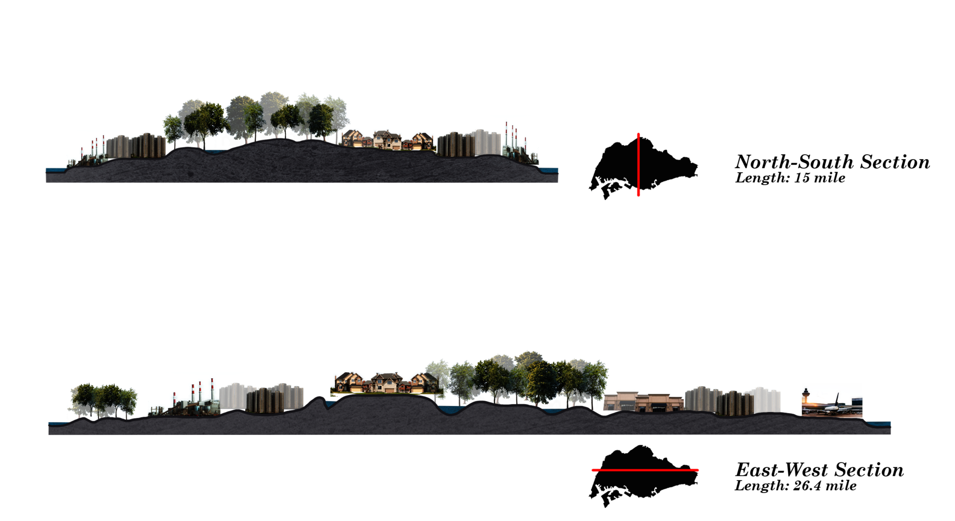
Regarding environmental and land costs, plants and factories are usually located on the outskirts of cities.
Between different land use, there are various “barriers” that helps reduce the impact on each other: it can be a green corridor, a water body, or a change of terrain.
Image
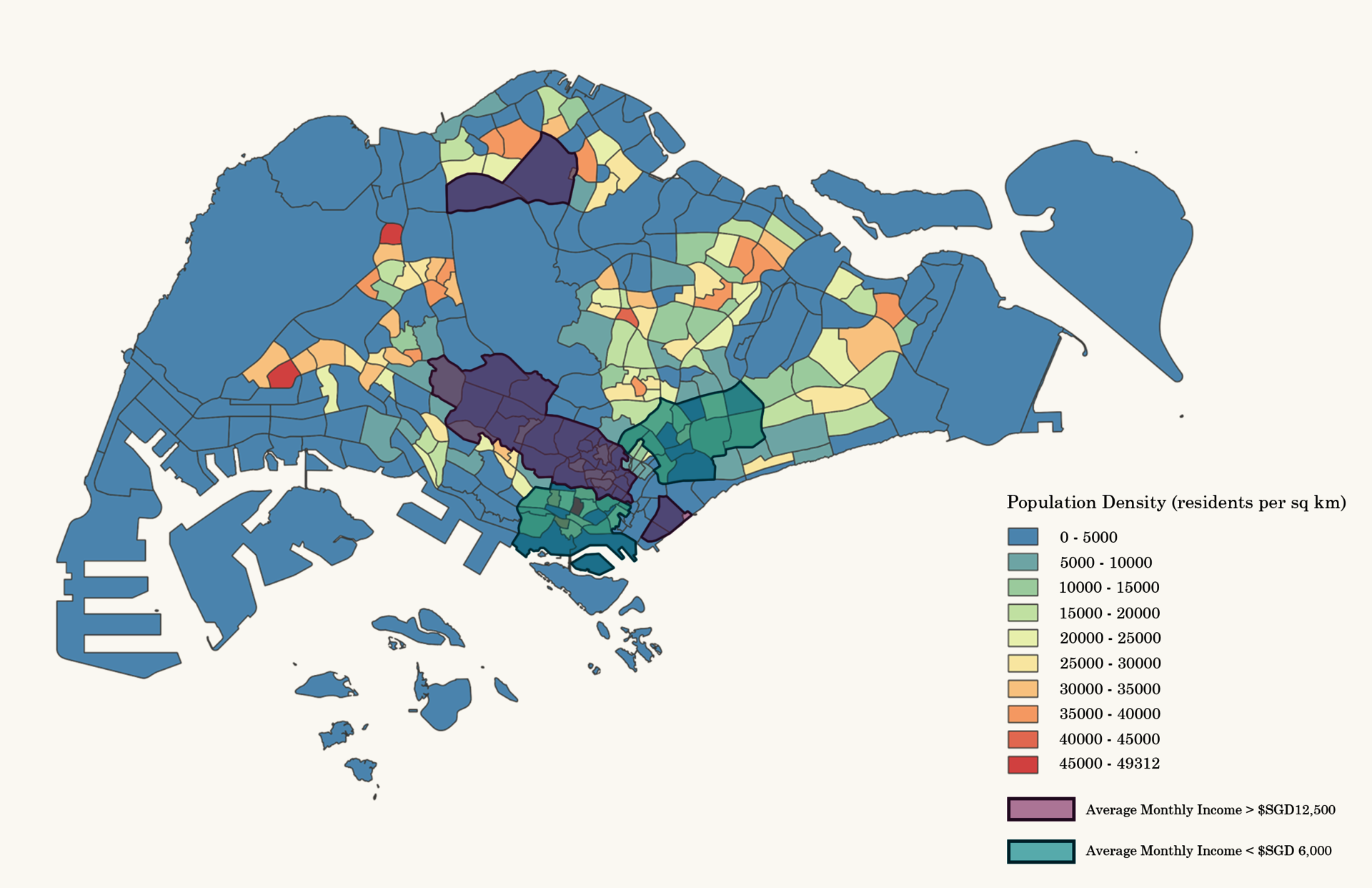
Three areas have the densest population in Singapore: two in the West Region and one in the Central Region.
People with the most and the least annual incomes are both in the Central Region. Many people live in these slum-like areas, resulting in low quality of life and uneven development.
Image
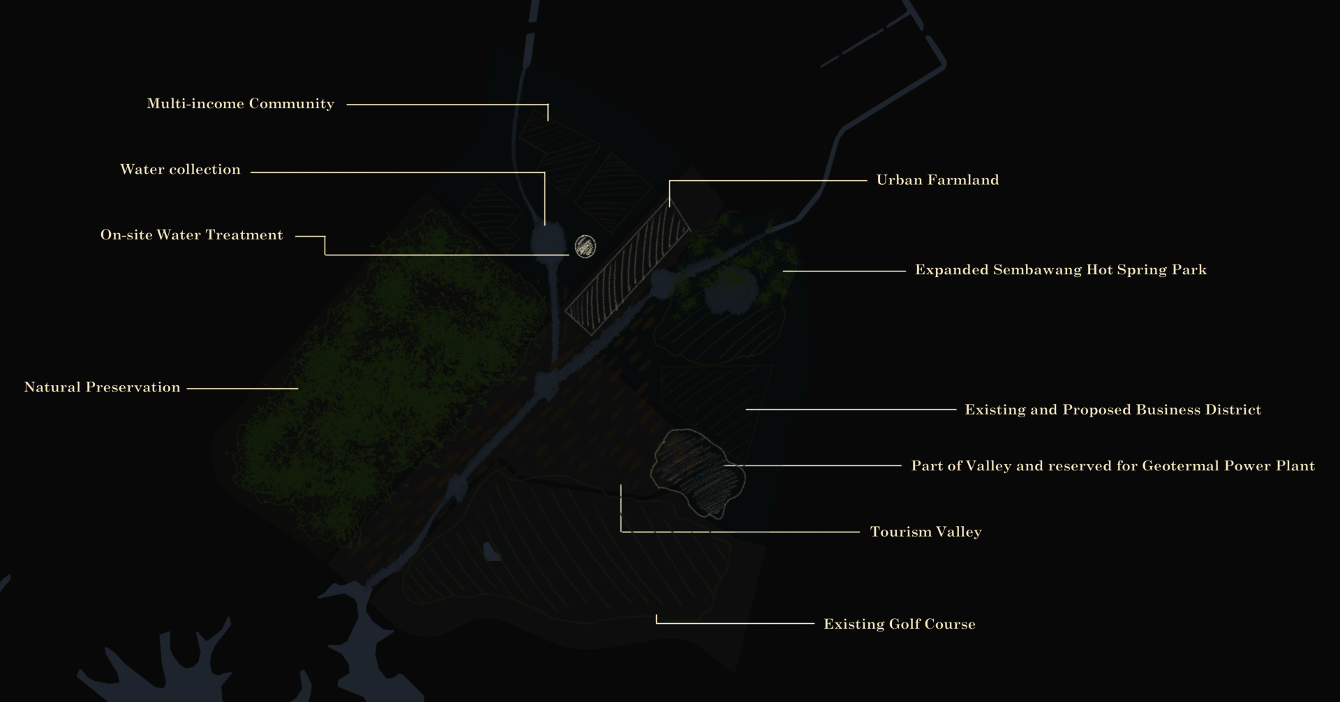
The testing site has been divided into a couple of pieces: The tourism valley in the middle is to open the space for recreational purposes while increasing the site’s mobility and accessibility. The multi-income residential area will increase affordable housing and reduce social inequality.
Image
Natural preservation will remain as they are in the short term. While the residential area and tourism valley will be fully developed in the future, the natural preservation zone can be introduced more productive functions.
Image
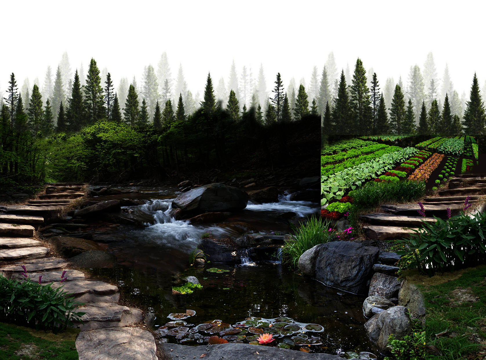
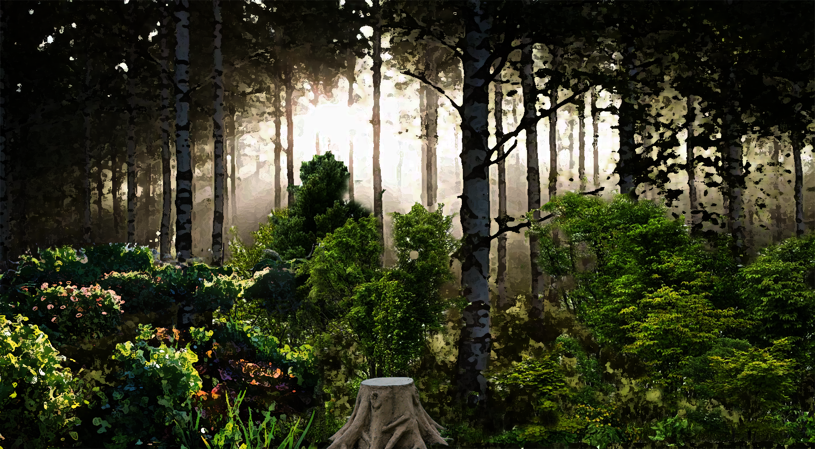
The tourism valley is in the middle of the site, while the golf course will be part of the valley in the future. The valley has several functions: create a water drainage path between the reservoir and outflow stream, enhance pedestrian accessibility, and serve as a natural recreation center.
Image
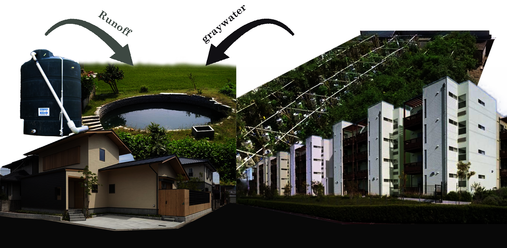
The multi-income residential area aims to reduce social inequality by creating more affordable housing. Open space at the rooftop can be reserved for urban farmland. The surface runoff water and gray water will be gathered and have initial filtration on-site.
Image
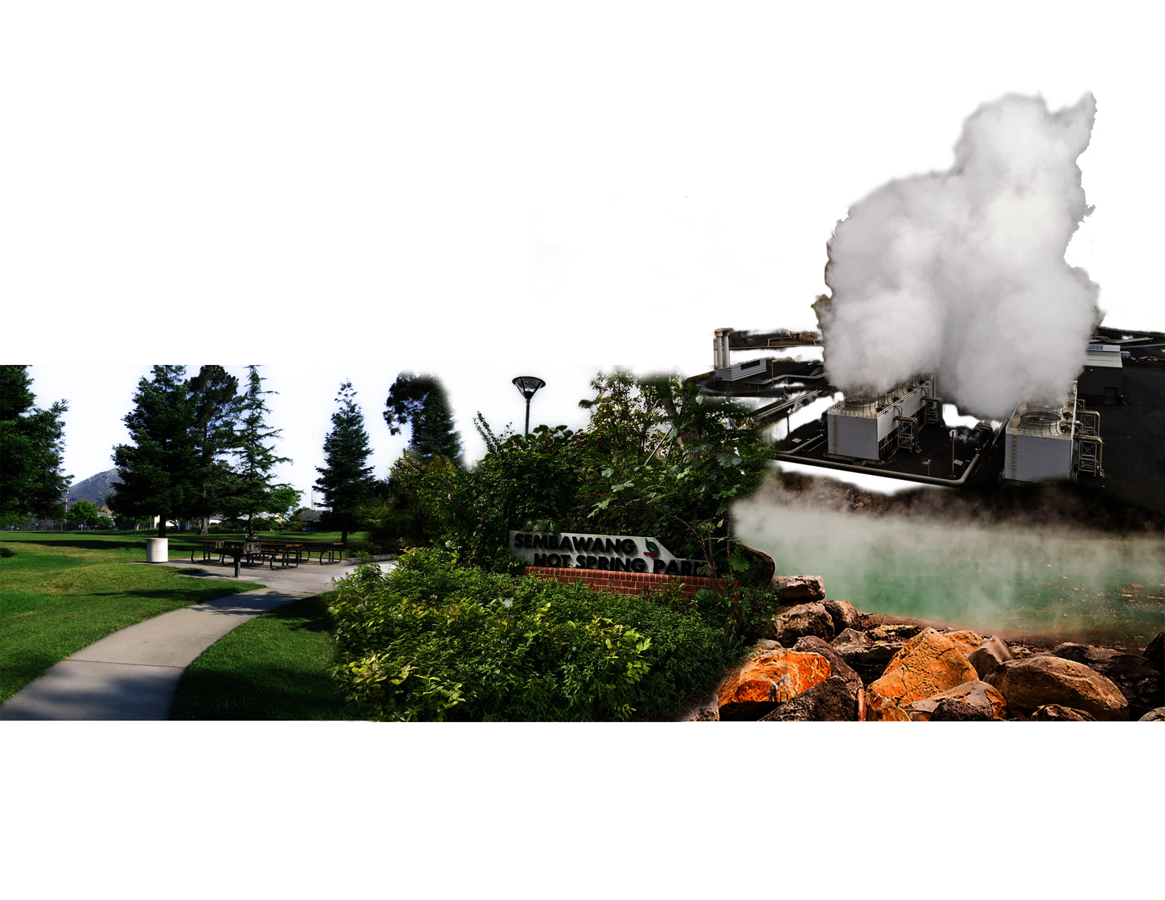
The Sembawang Hot Spring Park will be expanded and given more recreational programs. It can also reserve space for future geothermal power plants.