Kaixin
Zhang
Image
Image
Restorative Urbanism
Restorative Urbanism
Redefining Socio-ecosystems in Manila
This thesis explores coastal cities and the narrow zone lying between their developing urban areas and the waters of the open sea. Worldwide, there are more than 14 cities with populations over 10 million are situated along endangered coastlines. The fact that many of these continue to experience rapid growth, are economic centers of international importance, and are increasingly vulnerable to the impacts of climate change, is a matter of global concern. In this work I examine the implications and possibilities of restoring urban coastline defenses and ask how I can learn from past efforts while adapting such strategies to address other issues of pressing concern in such cities – issues such as social and economic inequities; affordable housing; food supplies; maintaining coastal livelihoods; management of waste; and equitable access to clean water.
Image
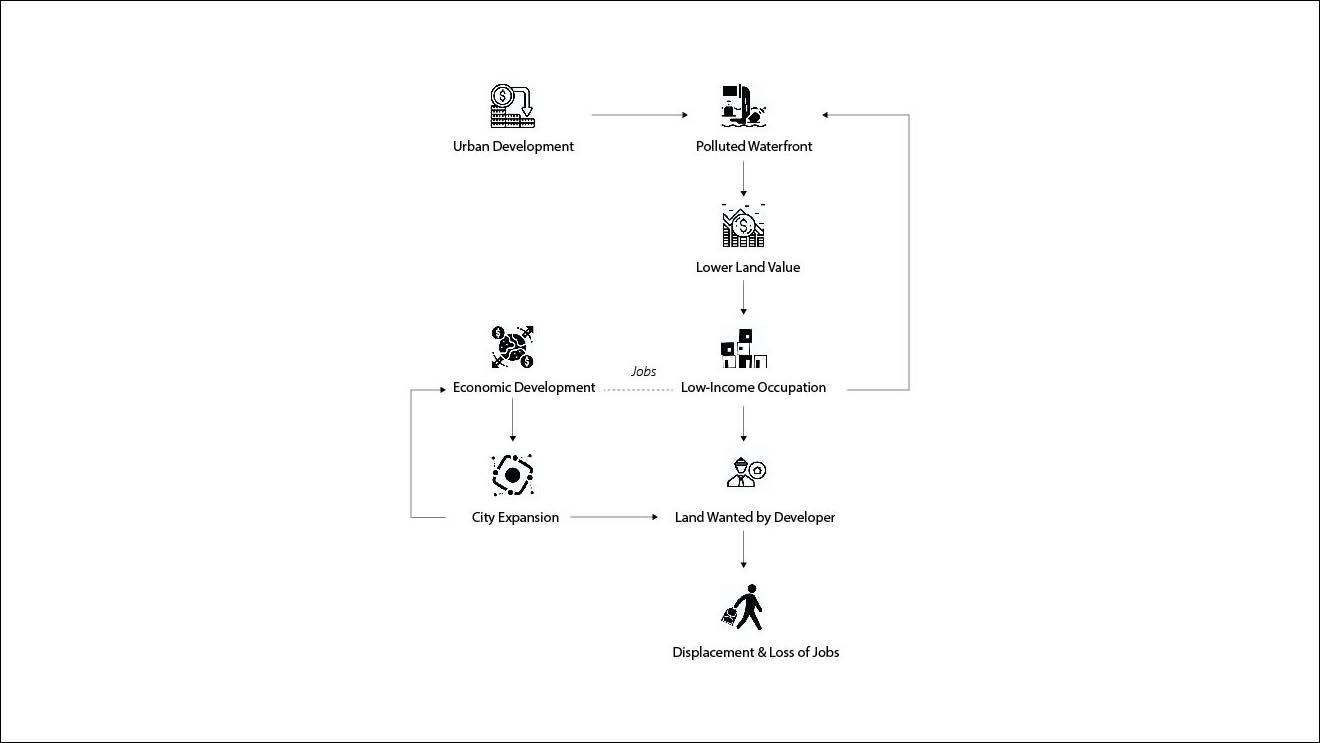
Background: A Typical Loop
The rapid urbanization has turned the land near (or even in) the water body most undesirable due to pollution, to extremely valuable and wanted by developers. However, now the informal settlements occupy the land after being displaced from the city center so that they are now facing pressures from both sides - water and city.
Image
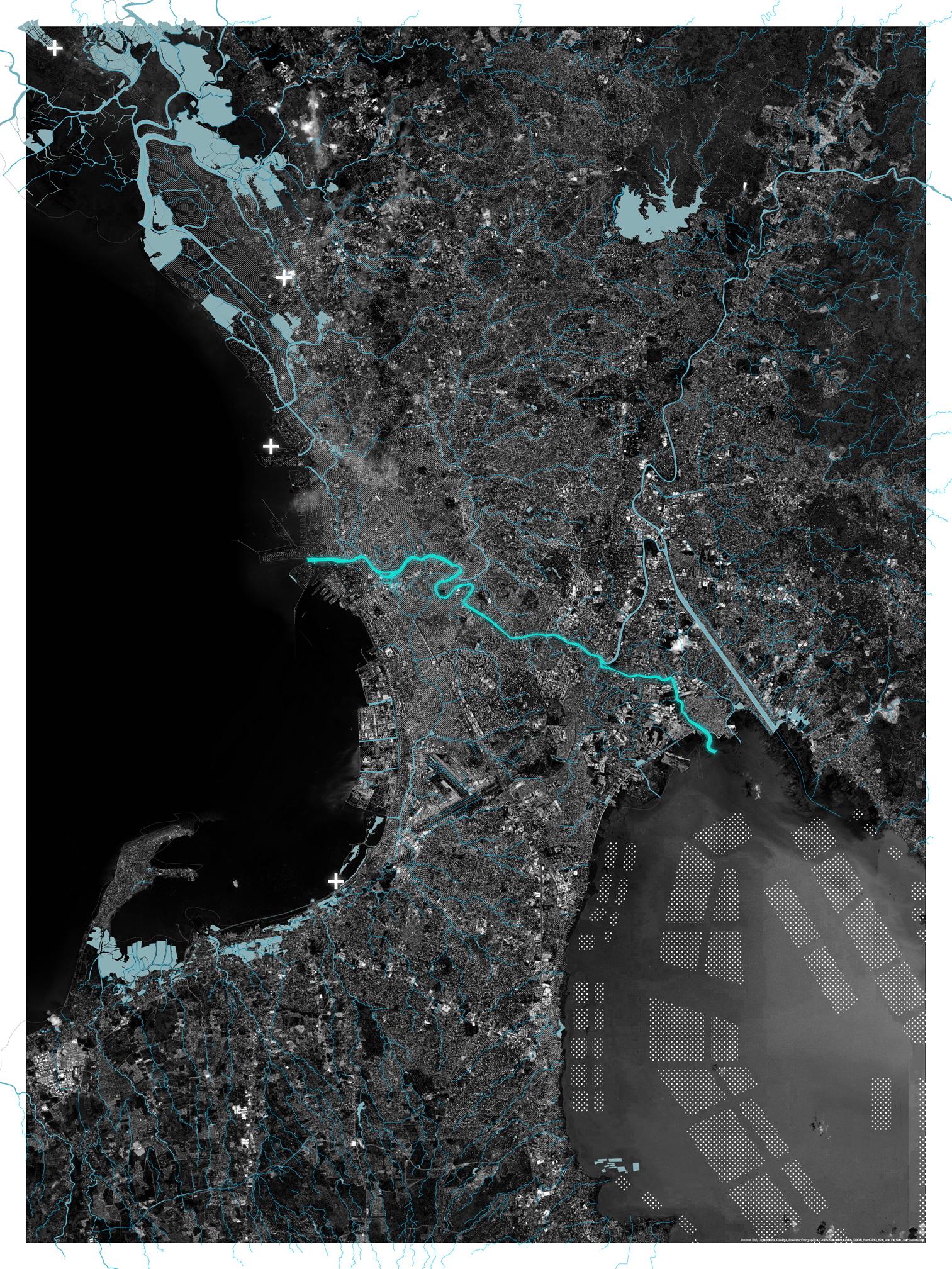
The Site Manila: Hydrology Diagram
City Manila sits at the east of Manila bay. Pasig River—a river running through the city center connecting the bay and lagoon, has different water flow direction in different seasons. In dry seasons, water from the mountains in the northeast makes river flow from lagoon to the bay, bringing sediments to the bay. On the contrary, in the wet season, flood and bay water are coming to the city and bring polluted coastal water from the river mouth to the lagoon. This kind of bouncing back and forward makes the waterfront area an undesirable place and hard edges are built along the riverbank.
Cross indicates there are fish ports and there are private fish farms in the lagoon area.
In cities in still-developing parts of the world, maintaining a balance between economic development, social equity, and ecological health is difficult. Different interest groups hold different opinions about the best use of urban and coastal lands. In this thesis I try to address each group’s concern through a strategy that starts with ecological restoration and protecting the urban coastline.
My site is the city of Manila in the Philippines. Here I offer a design framework and an adaptable flexible system of coastal restoration ecology and protected coastal communities, one that is critically linked to urban operations inland along the central city river corridor. This strategy I employ treats the vulnerable low-income communities living along the coast as a critical part of the new defensive ecosystem protecting the city from storm surges and flooding, thereby ensuring their right to live there.
Image
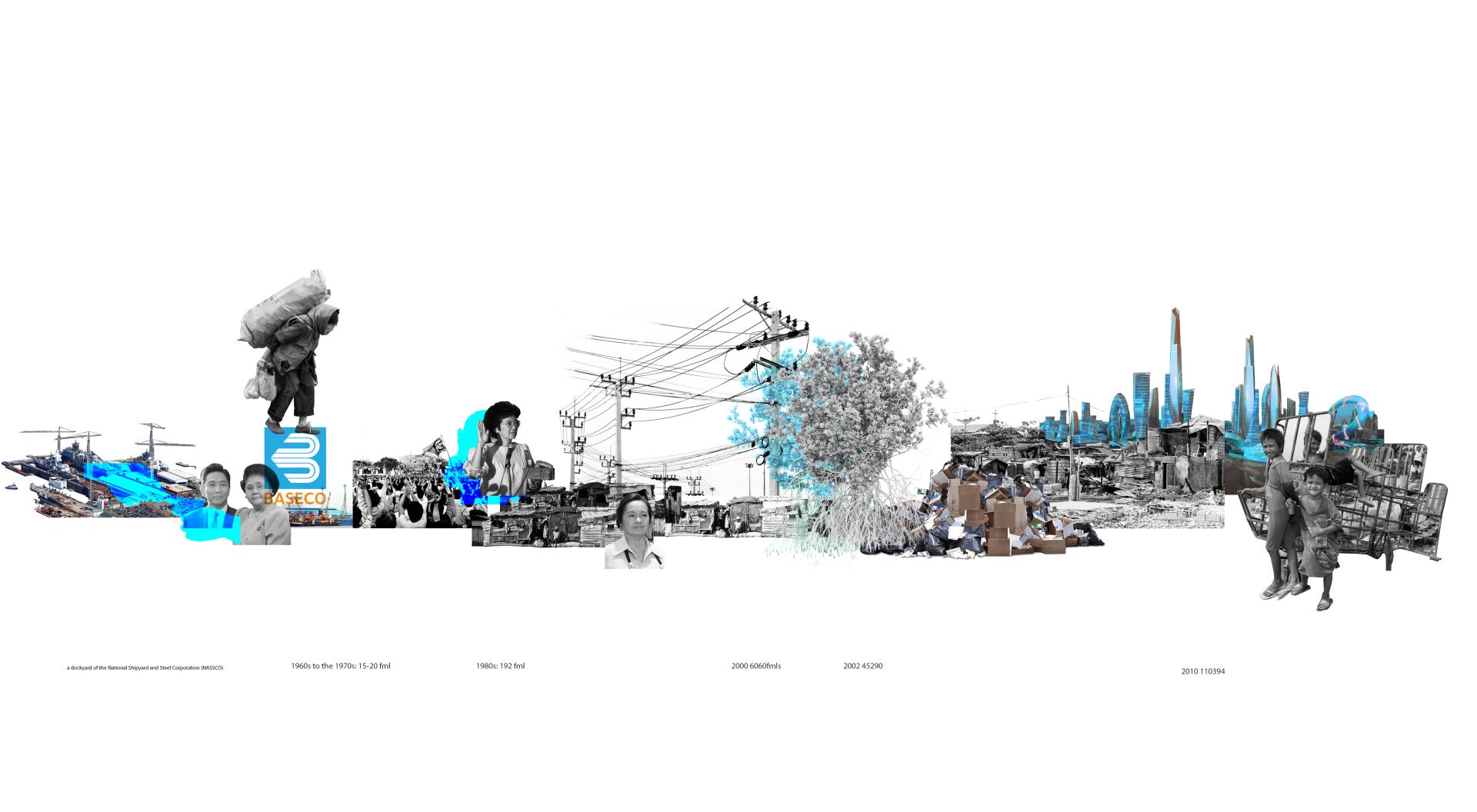
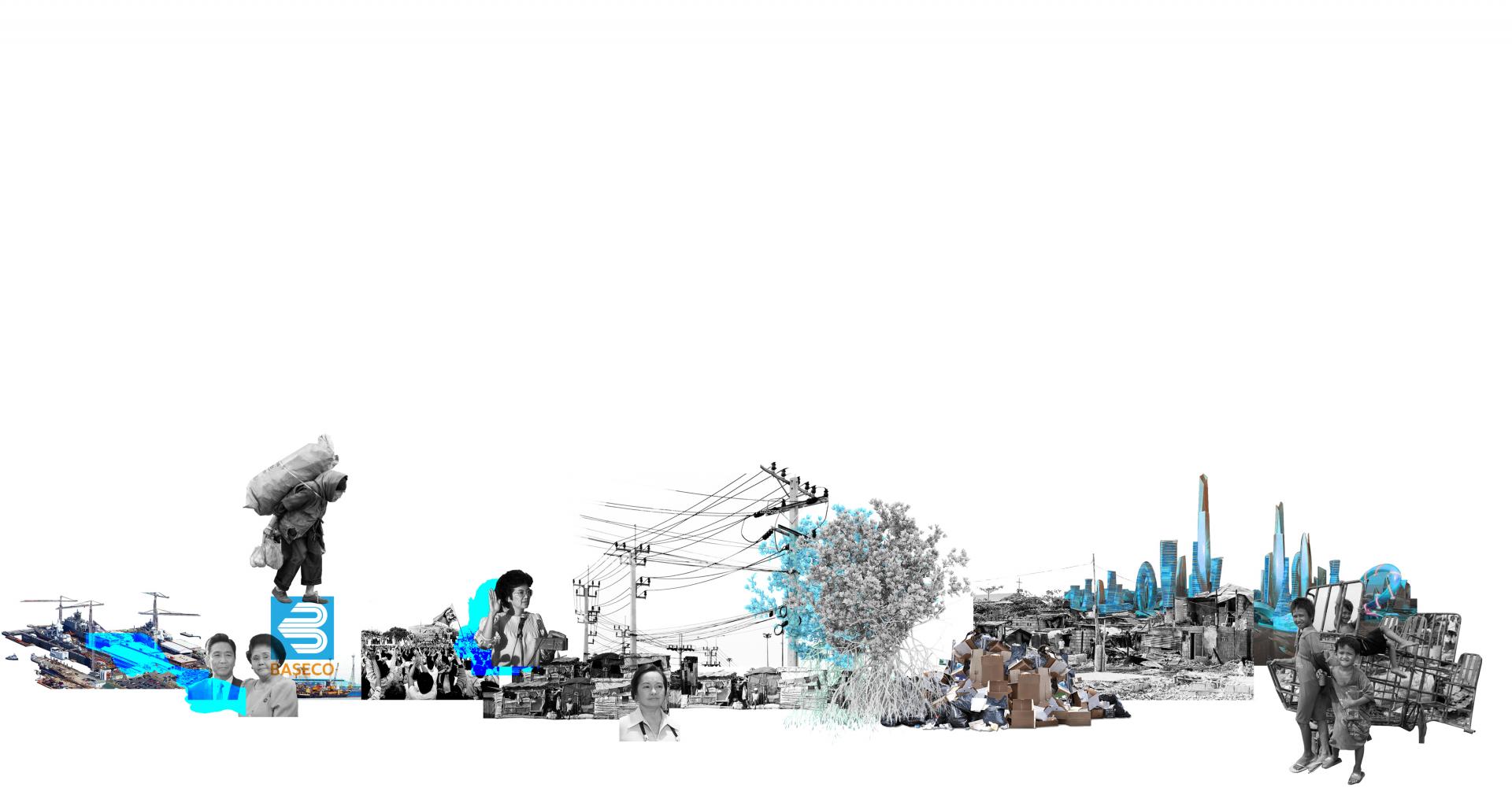
The Coastal Slum: BASECO Time Line
BASECO is the biggest slum area at the mouth of pasig river. Baseco is located on an unique land that once was for industrial use. Urban poors occupied the land since it was undesired due to industrial pollution around. Now it is facing pressure from developers that are seeking coastal areas to build high-end and mixed-use property.
Image

Plug-in Strategy: Plan
My proposal is to build a new scale of circular economy for Manila where the Bay-facing low-income residents are a fully integral, recognized and valued part of the city.
BASECO area: mangrove and floating houses communities creating new land.
City: potential stations along Pasig River bank with 2 boulevards in the city forming a green belt prevent the city from flood and hazards.
Image
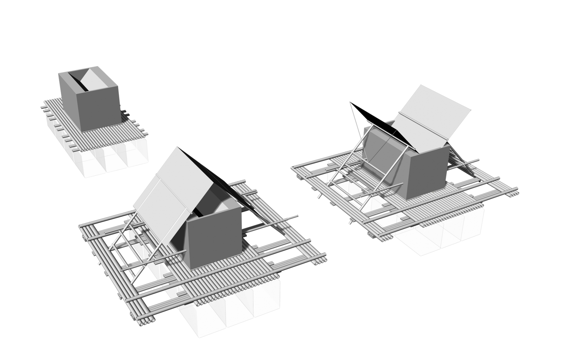
Module: Floating Houses
The inspiration of the floating structure design comes from local fishing boats having two bars at both sides to keep the balance. The base part is made with bamboo and house material is metal or any other they use. The roof can transform to capture water or use a solar panel to generate energy for daily life. Two houses are easy to assemble and connect through the side bars.
Image
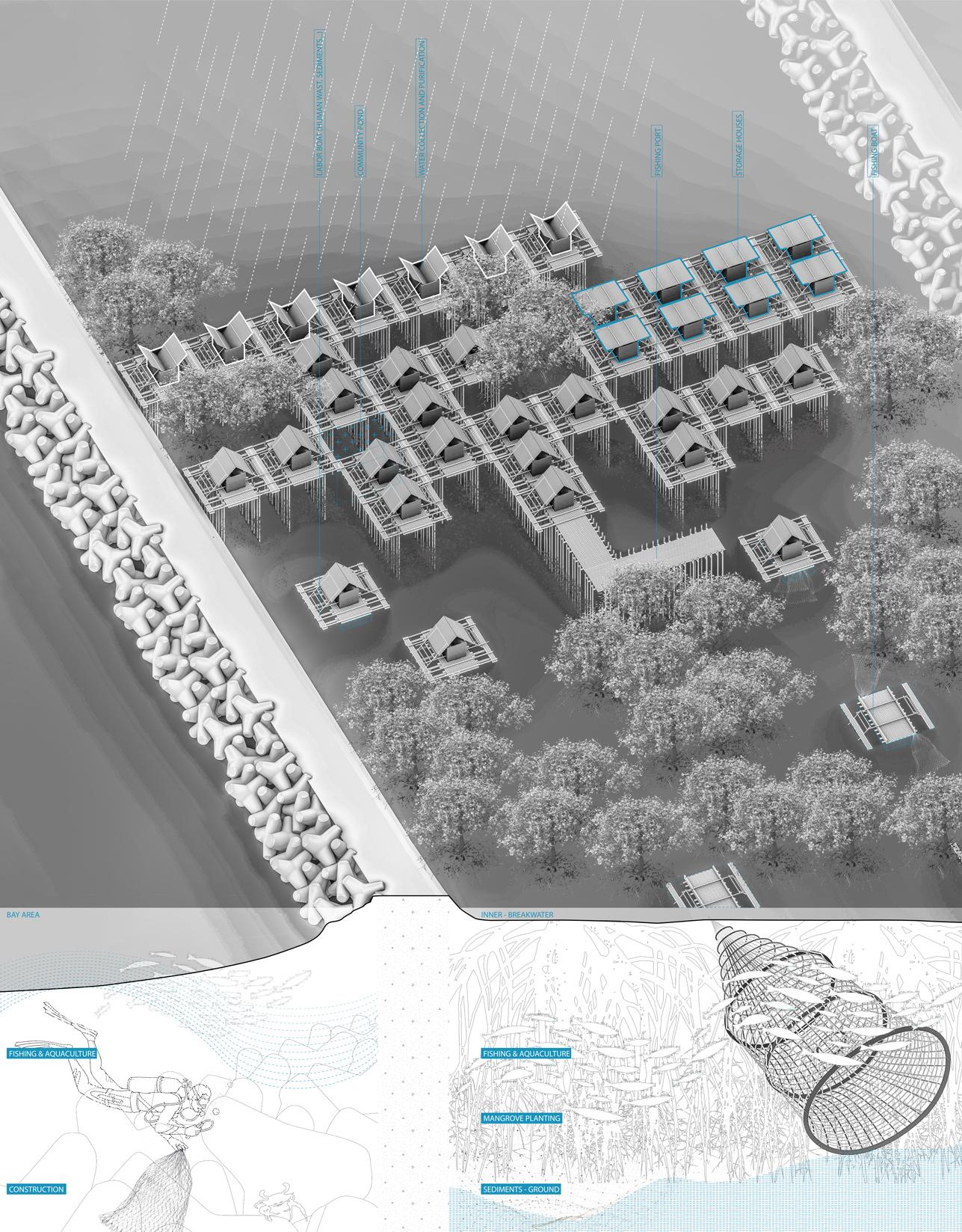
Building the land: Fishing Community
Zooming into the community scale, the different houses functioned in different ways and formed a duplicable community. The vertical structure below is to stabilize both sediment and floating houses, creating a barrier and speed up the land-building process at the inner side. Breakwaters are the main roads that connect back to BASECO triangle and the city area.
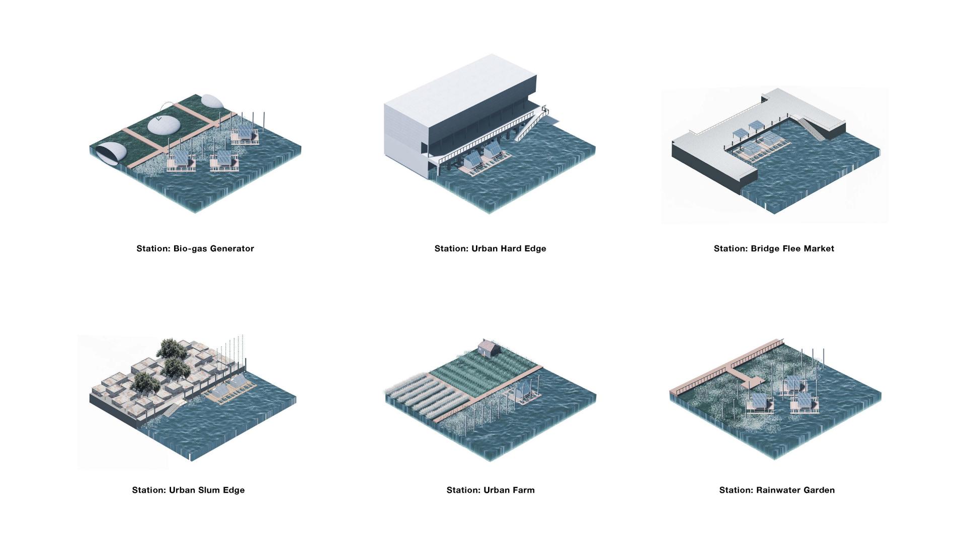
Stations in the City: Typology
Stations are arranged along pasig river and functioned as a continuous green space and benefiting the citizens. As the landing area for slum people to get to city, they also provide shelter places and working spaces for them.
Image
Image
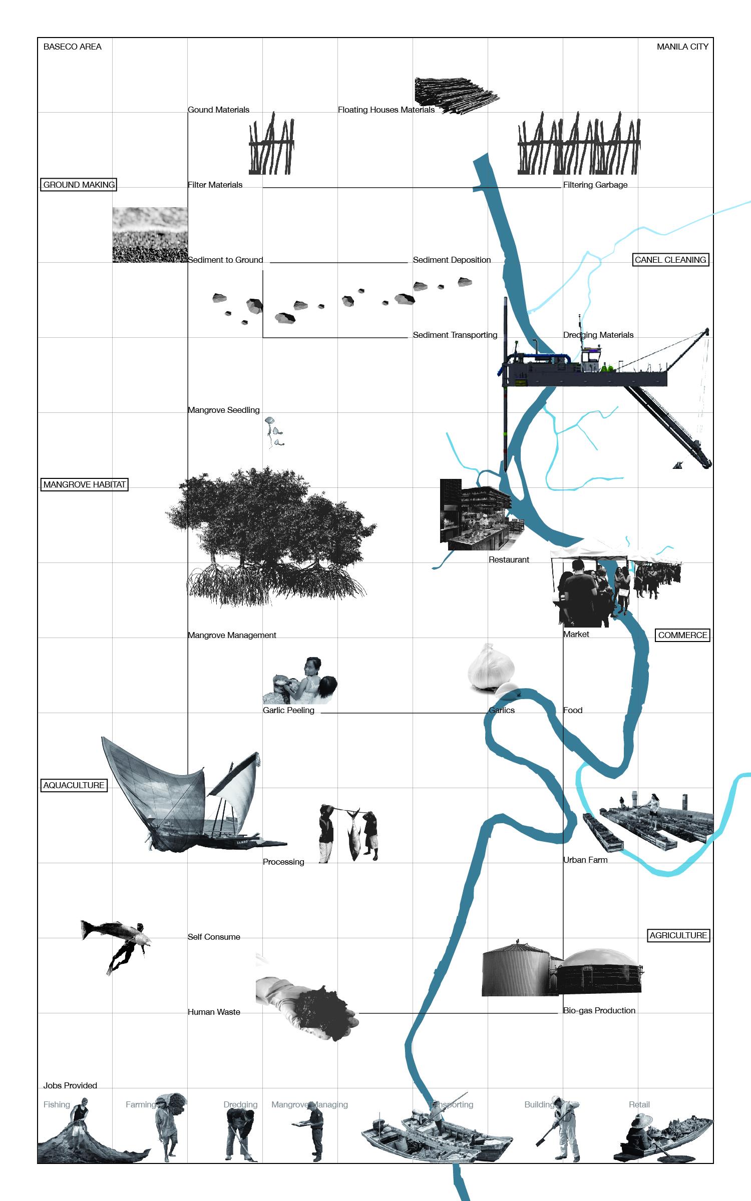
System Diagram
This system diagram explains how materials and energy flow between the coastal area and the city. Through the establishing and maintaining this dynamic system of transfer, use and reuse between Manila’s ocean-facing industries and fishing and the inland river-front recycling, land-building, flood management and agricultural activities, jobs are created.
Kaixin Zhang (goes by Joy) is a landscape designer who believes that landscape is a solution in the Anthropocene.