Kayla
Murgo
Image
Image
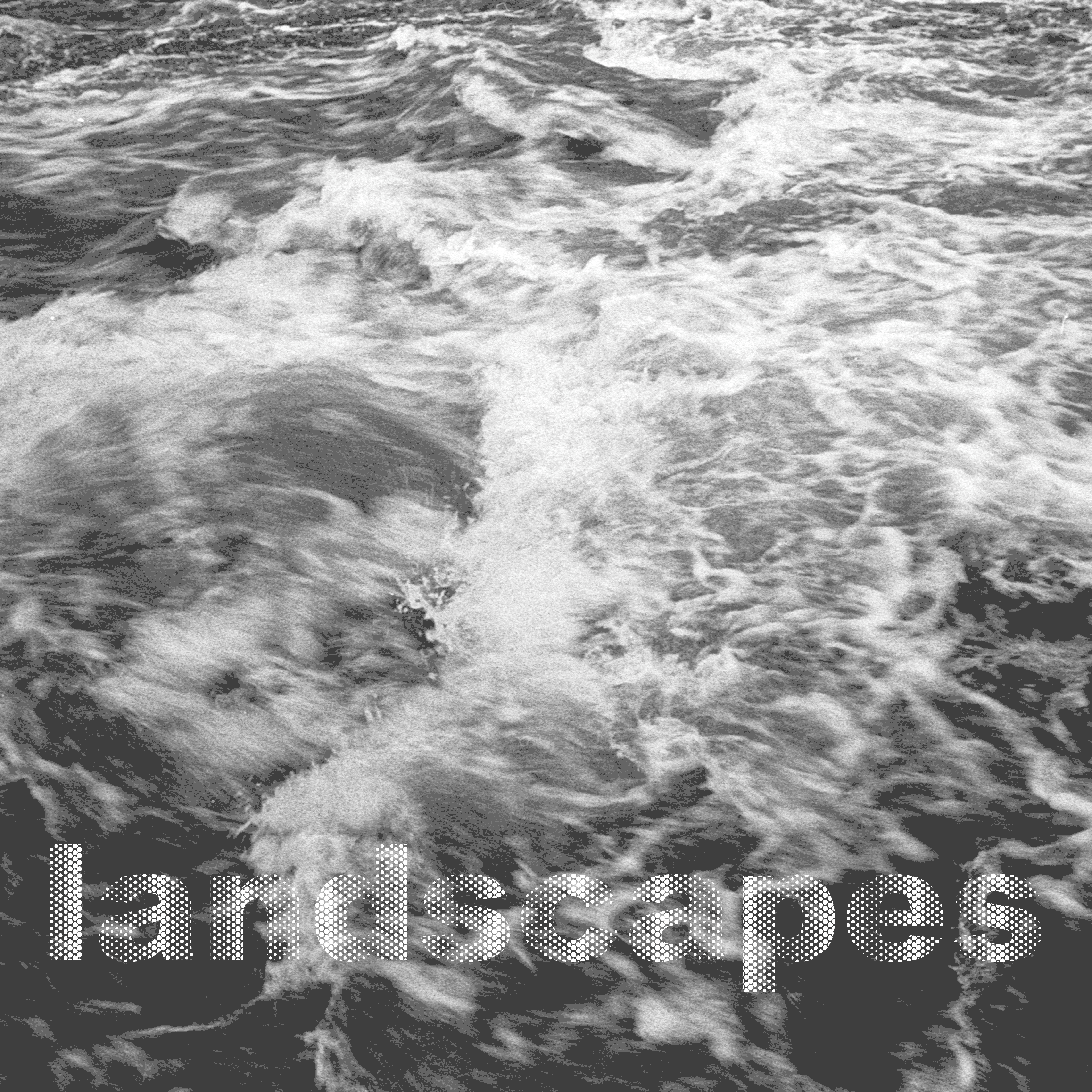
Landscapes of Exposure
Landscapes Of Exposure
Reframing the Connection Between
Body + Environment
This project explores new relationships of the body to the landscape through understanding how the environment imprints, molecularly, on the body and how that information is stored and inherited. In this age of postgenomics, a time that is defined by big-data and technology driven approaches to medicine and public health, it is imperative that we work interdisciplinarily to address mounting health and ecological concerns.
As shapers of natural and social systems, I believe that landscape architects can bridge scales, from the molecular to the ecological, to draw new conclusions about how humans impact ecological systems and how these impacts are taken back up by humans.
This thesis seeks to develop new ways of visualizing complex chemical exposures in our everyday lives in hopes of creating greater awareness and advocacy around issues of environmental health and justice.
Image

Image
Image
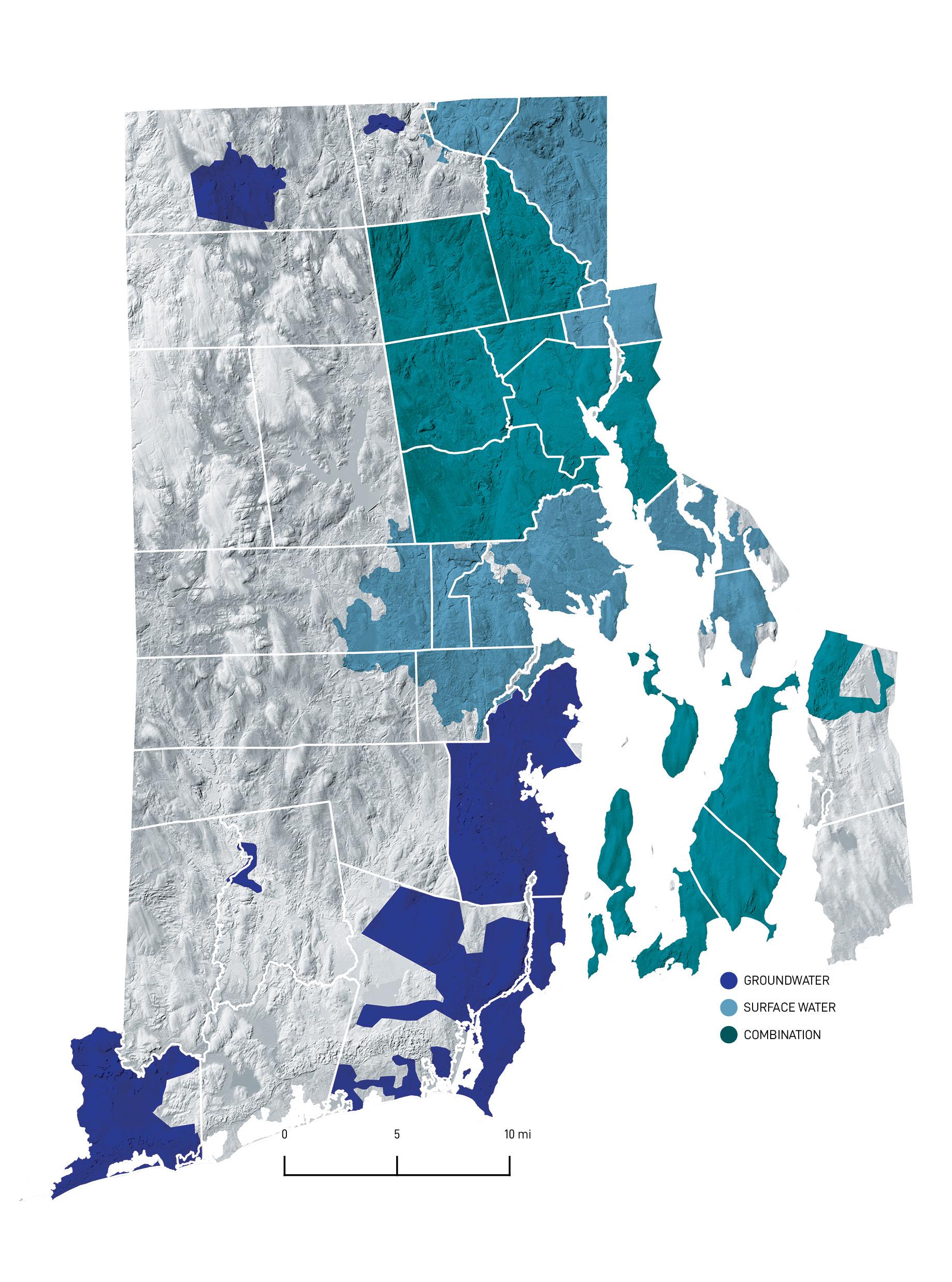
Drinking Water Resources
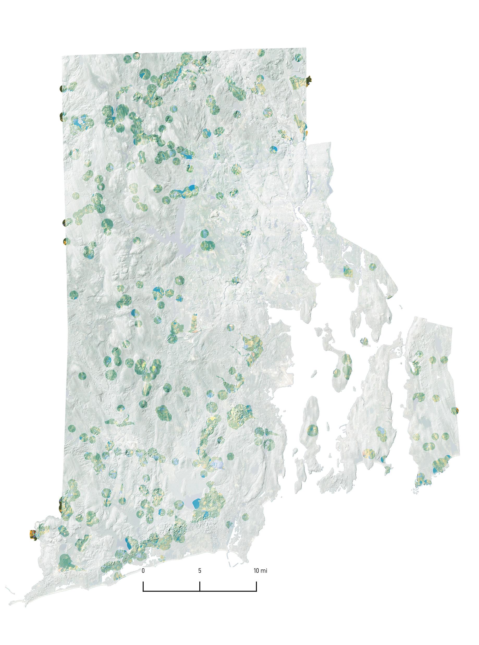
Rhode Island’s drinking water is provided by both public and private water supplies. This drinking water comes from both surface and groundwater systems. Some communities rely solely on one or the other while others utilize a combination of the two. 26% of Rhode Island’s population relies on groundwater that comes from both public supplies and private wells. Approximately 70% of municipalities in the state rely on groundwater to a significant degree as a source of drinking water.
Land Use In Wellhead Protection Areas
A Wellhead Protection Area (WHPA) is the portion of an aquifer through which groundwater moves to a well. The size of a WHPA is determined based on the medium in which the well is placed. The WHPA of a bedrock well is drawn as a circle whose radius is based on the pump rate of the well. The WHPA of a Stratified Drift well is based on an EPA model that incorporates topography and material. 15% of Rhode Island’s land area is recognized as Wellhead Protection Areas.
Image
Image
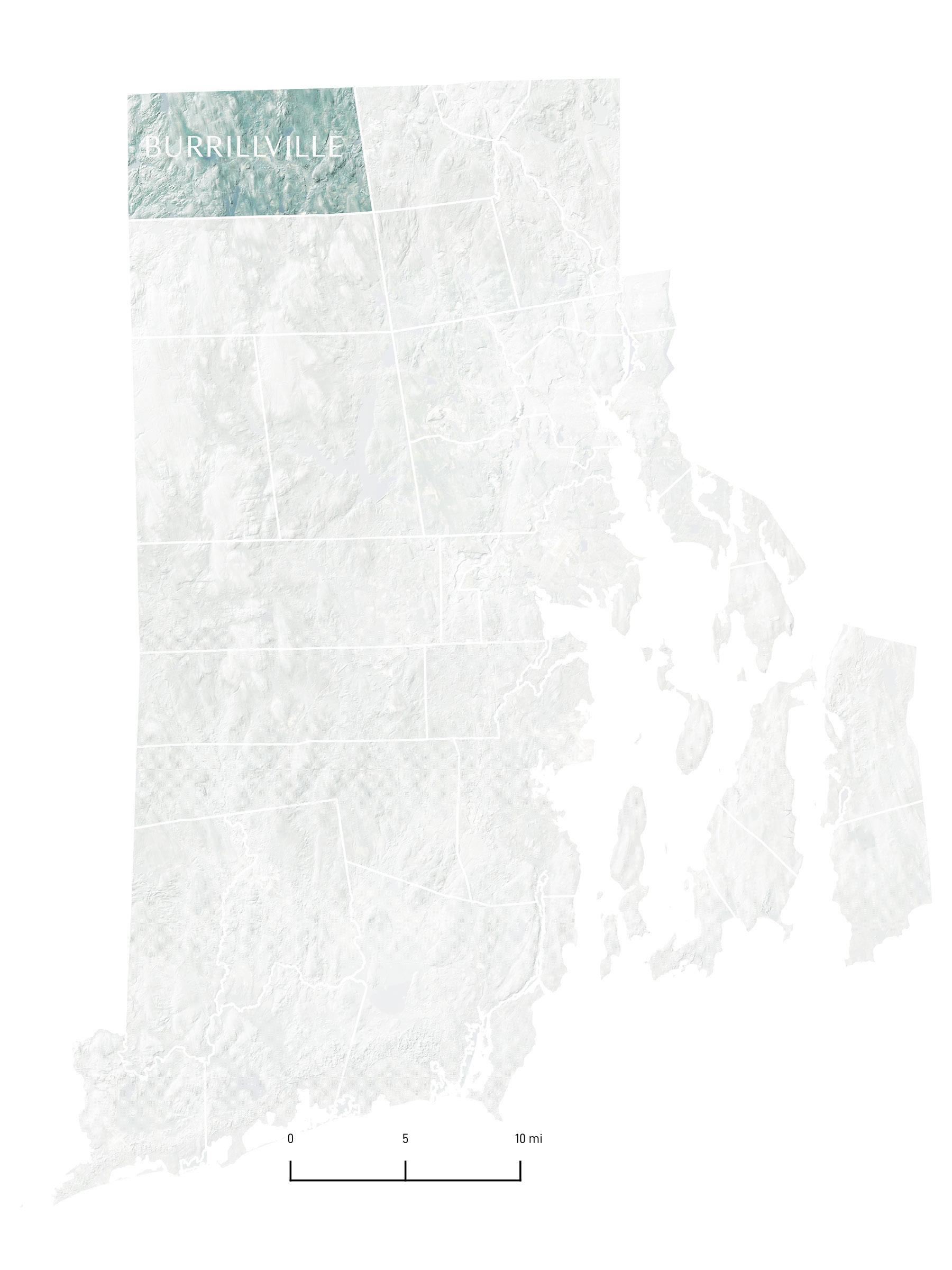
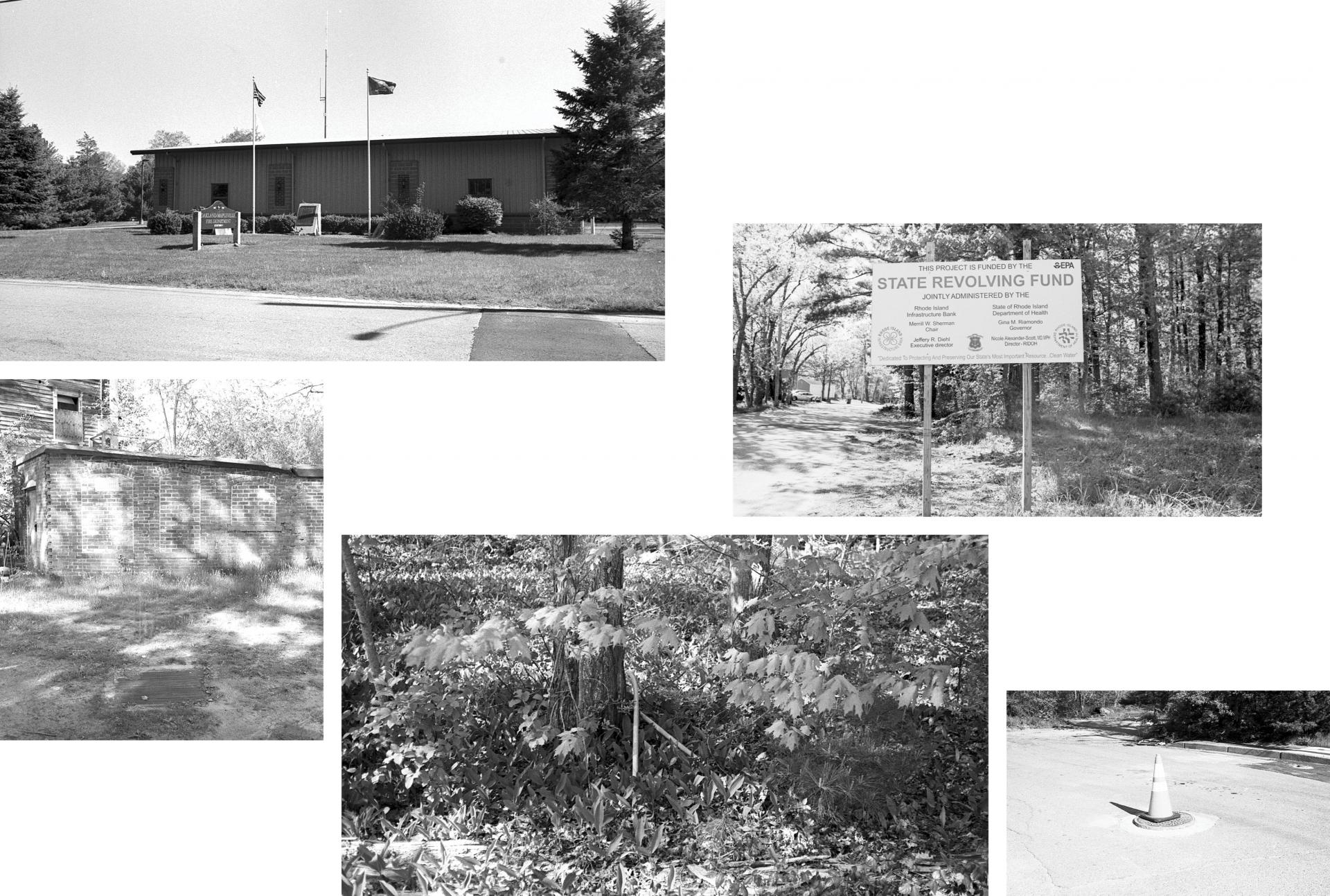
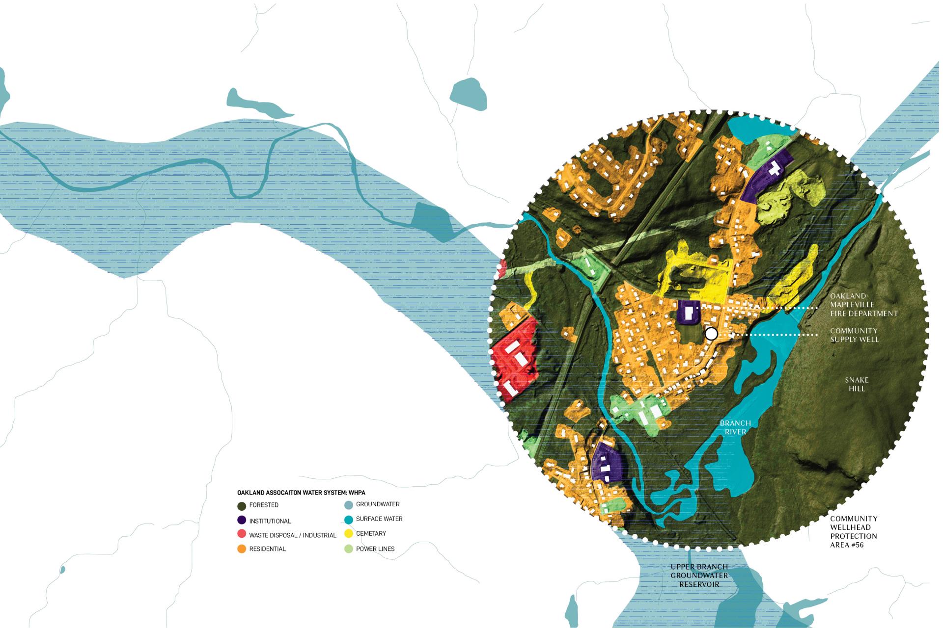
Oakland-Mapleville Fire District
Targeted testing by the RIDOH and Brown University revealed elevated rates of PFOS and PFOA in the Oakland-Mapleville area of Burrillville, RI. The Oakland Association community well serviced 175 residents of the local community. The well was located on the same property as the Oakland-Mapleville Fire Department where PFAS-laden AFFF was being stored. It is speculated that the foam leaked out of its storage container and entered the groundwater supply at some point since the fire station was built. Residents have been supplied with alternative water sources since the contamination was discovered. A new line has since been built which connects the Oakland Village area to the Harrisville Water public supply.
Image
Image
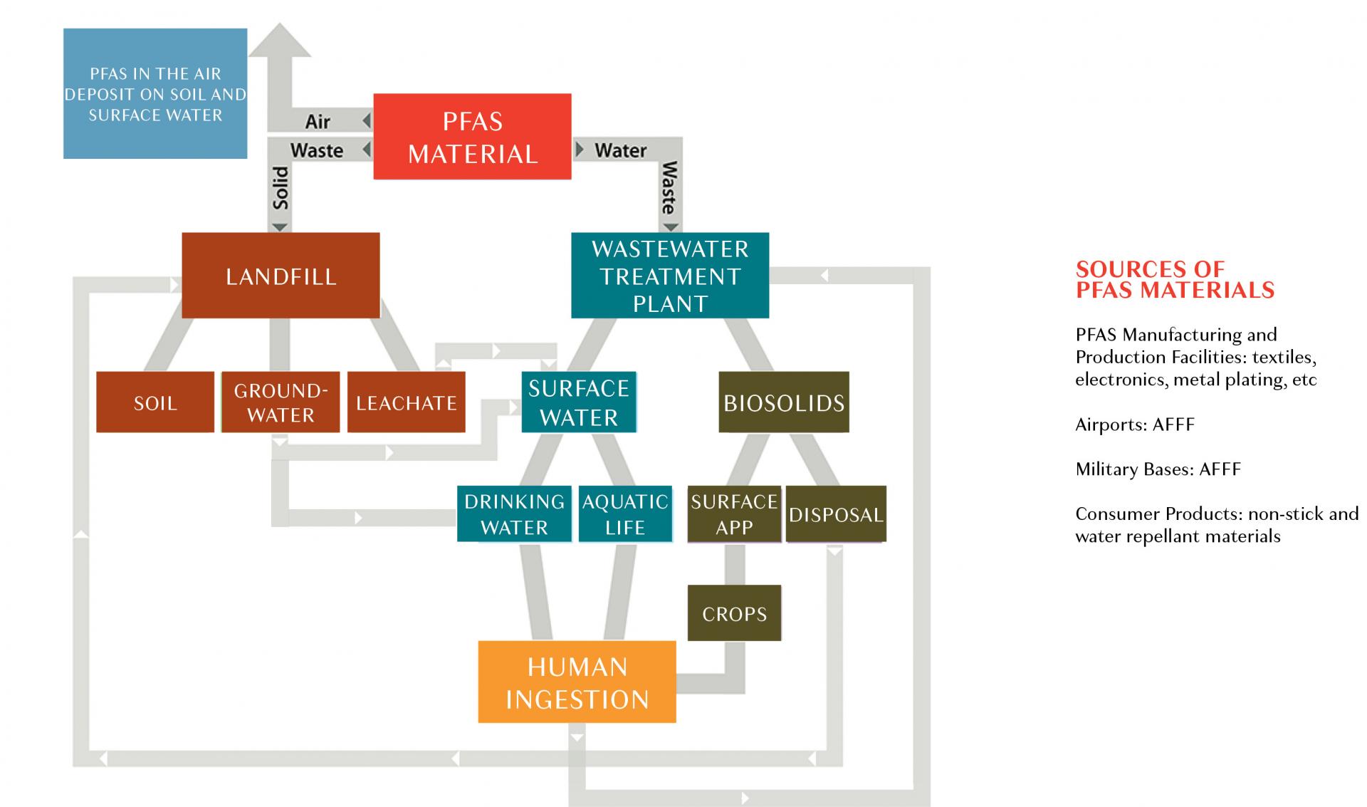
PFAS Movement
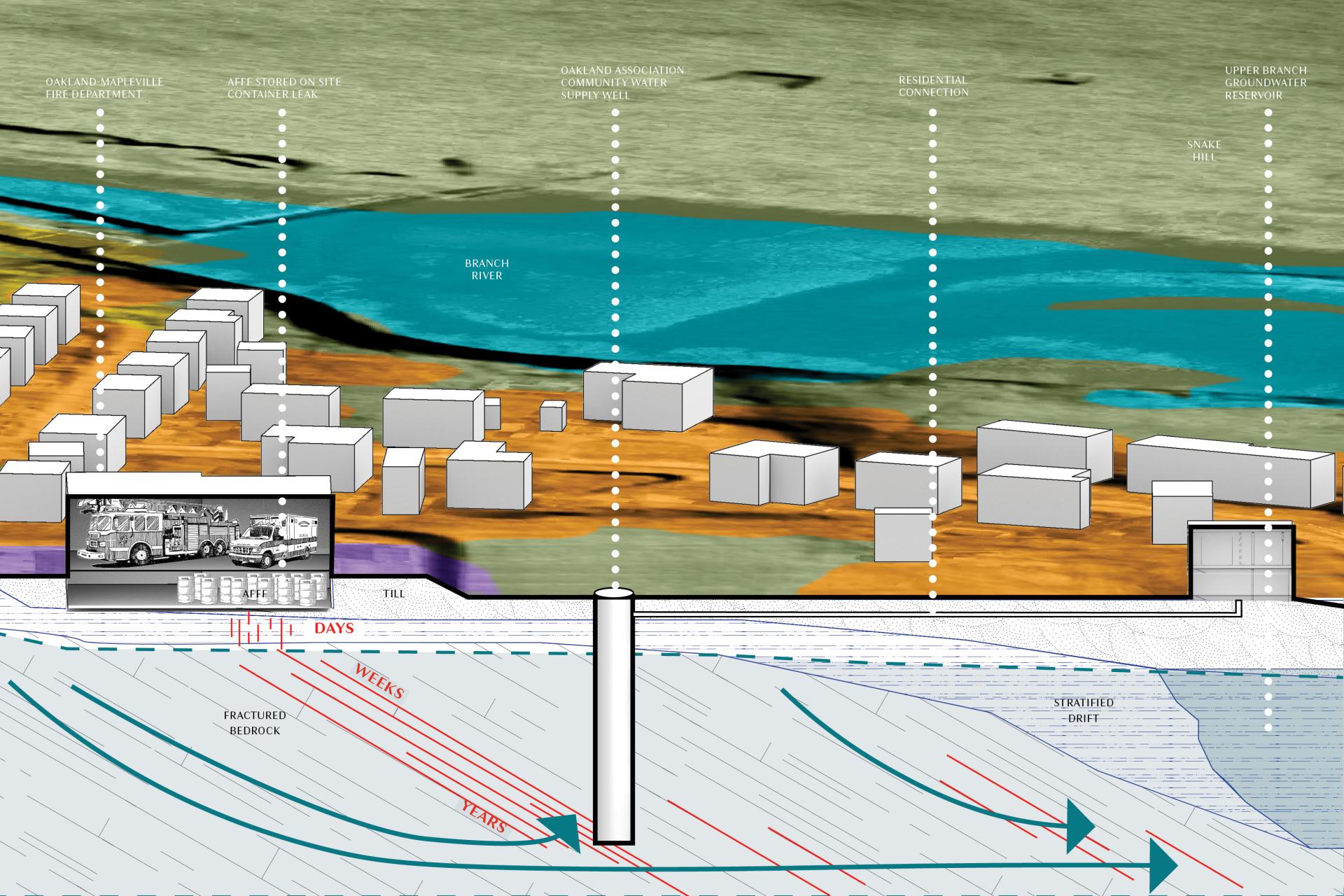
This section explores the connection between land use and groundwater contamination. AFFF stored at the Oakland-Mapleville Fire Department is suspected to have leaked and entered the soil below the building. This parcel is situated in the WHPA of the Oakland Association well and groundwater captured in this zone is known to have the ability to impact drinking water quality. The public supply well, located just southeast of the fire department property, and drilled about 200’ into the bedrock, was extremely susceptible to PFAS contamination. It is likely that the chemicals traveled through the same fractured bedrock channels that allow for the movement of groundwater. The chemical movement was likely quick through the surface material, but took much longer to make its way through the deep crevices of the bedrock below. Since the exact date of the leak is not known, it may have occurred years before the contaminant began to affect water quality.
Image
Oakland Village’s water infrastructure has changed drastically since the PFAS contamination was first identified. Large sections of road have been torn up to accommodate new pipelines carrying water from nearby Harrisville Water supply. The community’s old pump house lies in disrepair atop the old community well.
Kayla Murgo sees the endless potential in landscape architecture to address many of humankind’s most pressing issues. She finds deep inspiration and optimism in the dynamic, adaptable and regenerative forces of landscape. Kayla is interested in how the landscape is embedded and transported temporally through the physical body. She believes that interdisciplinary research, between social sciences, health sciences and design, centered around issues of equity, will lead to a more just and resilient future.
In her free time Kayla can be found frequenting her local park or beach with her dog, Scout. Kayla has a degree in Biological Sciences from the University of Rhode Island and a Masters in Landscape Architecture from the Rhode Island School of Design.
Contact
kaylamurgo@gmail.com
Instagram