Qing
Liu
Image
Image
3D SIMULATION IN FLOODING PROVIDENCE
3D Simulation in Flooding Providence
This thesis is going to use 3d data visualization to provide the scenarios of how global climate changes will influence people’s life if we don’t take actions as soon as possible, which provide no-professional people an easy way to understand the urban issues and engage them into the environmental protection. My proposal is to visualize the flooding issues in Providence by using kinds of simulation tools, including 3d model, augmented reality(AR), animation in order arise the awareness of climate change and the significance of human’s actions to protect the living environments. These simulations also provide the support for the designers and policy-makers to adjust management strategies when they are thinking about the long-term urban planning.
Image
Site
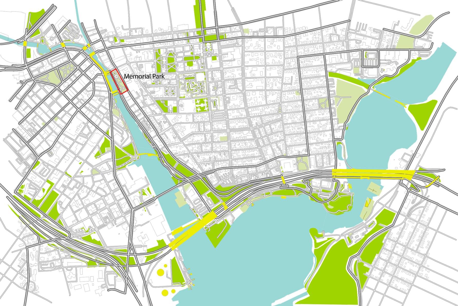
The site is Memorial Park, Providence, RI. This sculpture-filled park pays homage to people who gave their lives during wars and conflicts around the world. This park is located in downtown Providence, closed to RISD, Brown, and also near to the business buildings. People always come to talk, smoke, eat lunch along the river. There are many activities happening on the park during the year. Some of them are mainly held for the Waterfire, the most attractive activity in Providence.
Image
Diagram
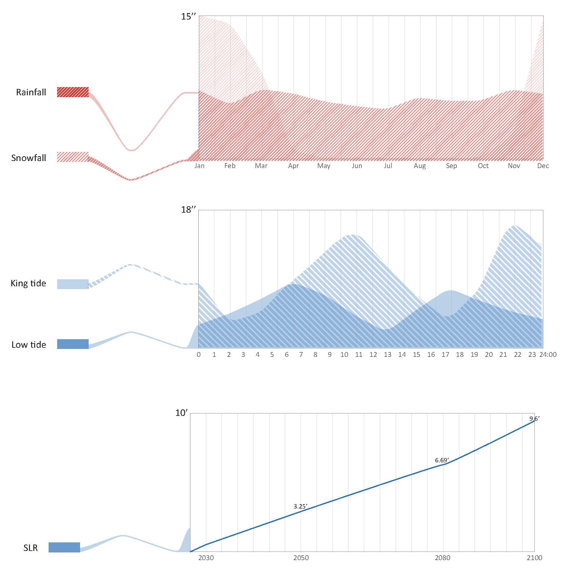
National Oceanic and Atmospheric Administration (NOAA) projects up to 9.6 feet of SLR in Rhode Island by 2100. This projection is based on NOAA’s 2017 analysis of SLR scenarios, the latest NOAA “high” curve projects 1.67 feet of SLR for 2030, 3.25 feet for 2050, and 6.69 feet for 2080.
Image
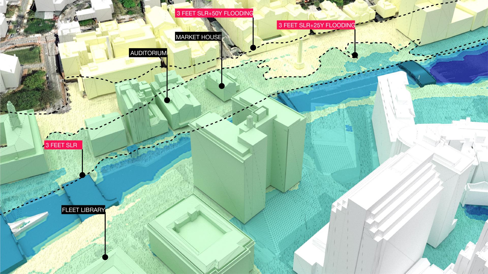
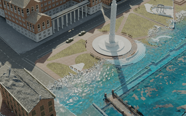
3D model
For the first simulation method, I used 3D modeling, which is also the most commonly method used in architecture. I build a model of the site, and reflected the results I got from maps into the structures of the models. Different materials and colors are used to show the difference in the level of impact of flooding. It is clear to know which structure is influence, but it’s hard to say how high the water will be and if the water actually influence the working process of these facilities or not. So I start to think about another way can simulate the height of water, and make people clearly know the threats of flooding.
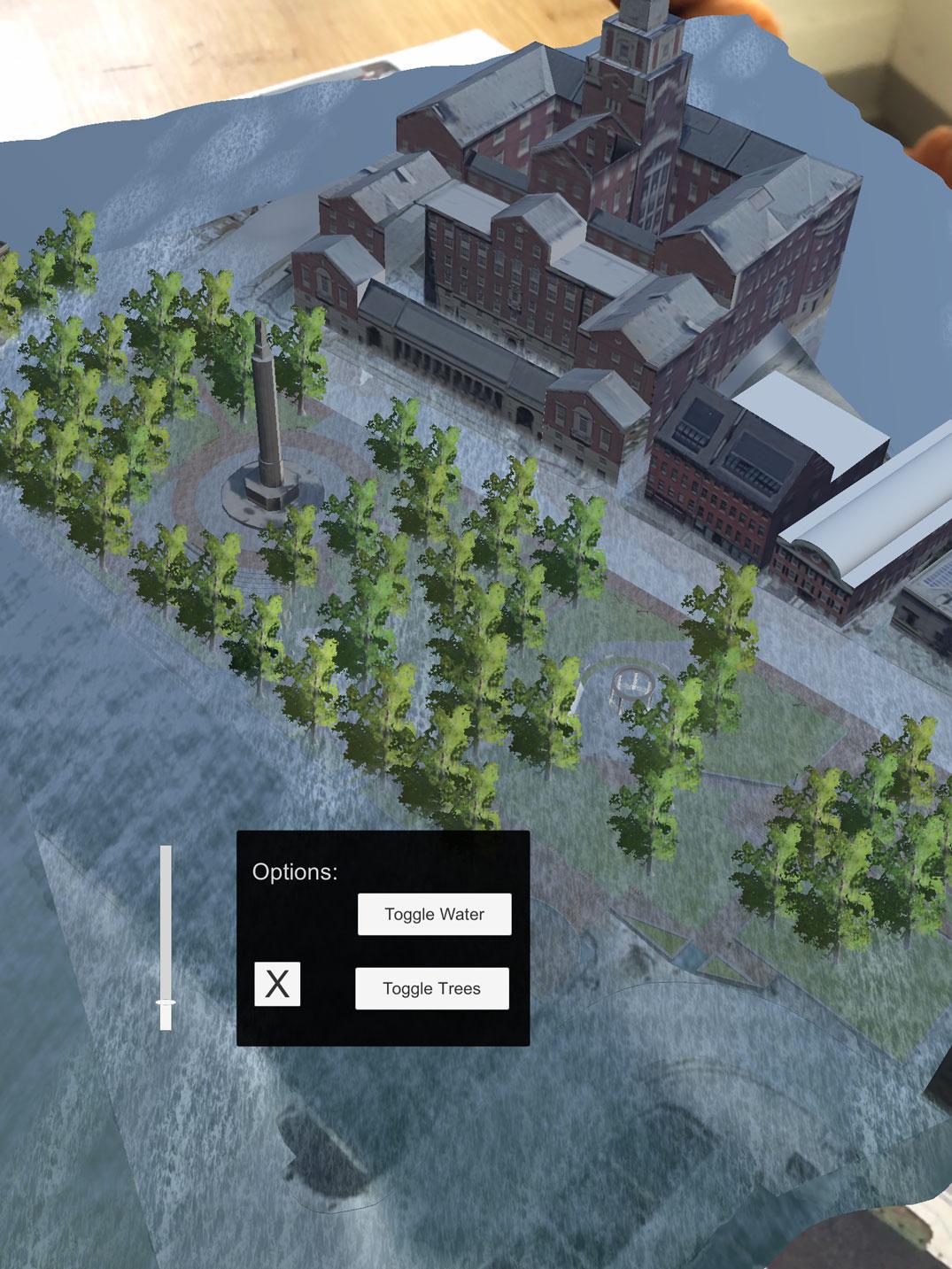
AR
The second method I use in urban simulation game is augmented reality. If you scan a flat site plan, a 3D site model appears on it. It means that I have “2 realities”—the site plan which is informative and flat, and the 3D model which begins to bring in more information and possibly offers the chance to show perspective and emotion. Also, there are many buttons along the screen, which allows you to easily interact with the game and change aspects of the site model, like the water level and availability of trees. So designers don’t have to spend a long time to have dialogues with kinds of stakeholders.
Image
Image
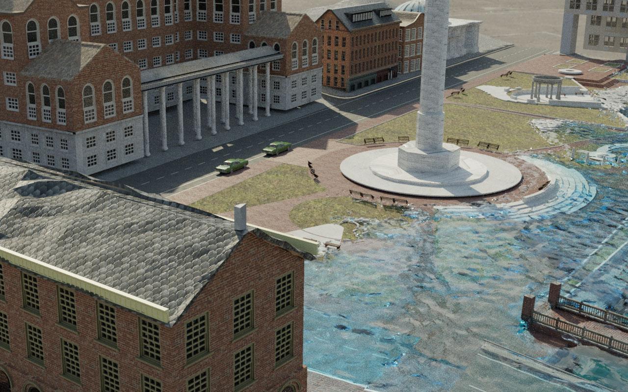
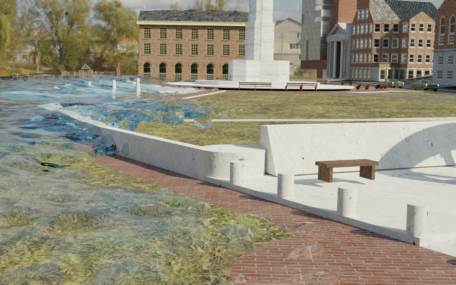
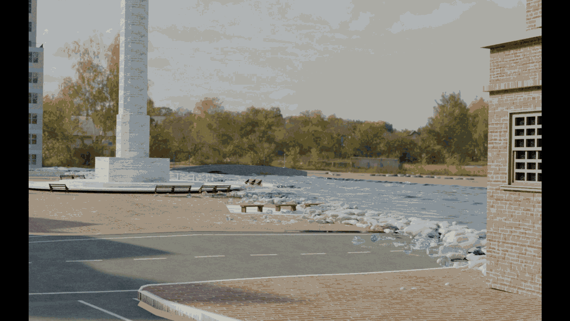
Animation
Animation is a method in which figures are manipulated to appear as moving images, which means we can use this media to show the dynamic movement of flooding to illustrate the nature and extent of flooding events.
Image
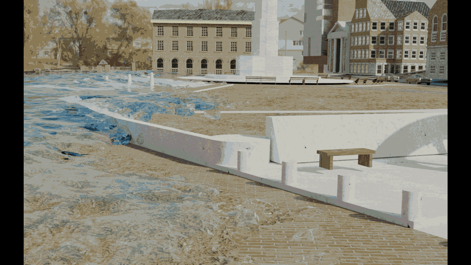
Moment
You can see the process of water entering the site. You can tell the different results based on whether there are any obstructions or not. These simulations allow the observer to directly see the damage caused by the flood to the site they are familiar with and how they will affect their life. This is the biggest difference from the other two methods.
Image
Image
Qing Liu has a background in economics. She is interested in data-driven analysis and engaging the audience into the context to raise people’s concerns about the environment. She has been working with different scales of design projects from inception to construction, and also worked as engineers in some projects to engage the audience into the outer context by the digital art pieces. She has participated in many interactive projects in many fields including apparel, textile, landscape architecture and urban planning.
Contact
qliu01@risd.edu
+1 401 618 4321